Ward-Thomas Museum
![]()

Buildings
Prior to Urban Renewal in Niles, Ohio
1972-1976
Ward — Thomas
Museum
Home of the Niles Historical Society
503 Brown Street Niles, Ohio 44446
Click here to become a Niles Historical Society Member or to renew your membership
Click on any photograph to view a larger image, click on image again to zoom into photograph.
| Buildings
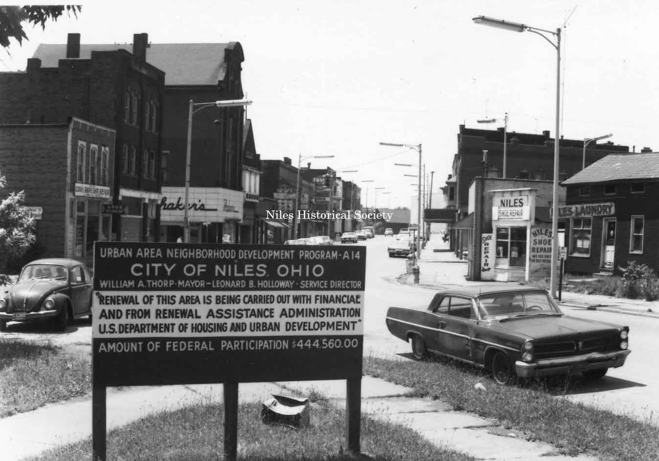
Prior to Urban Renewal in Niles, Ohio. Once a thriving business community, the downtown area began its decline in the 1930’s. The Saturday night shoppers who crowded the downtown streets had disappeared and much of the sense of community that had highlighted the city’s history was lost. The Hoffman Store fire of 1962 was a real tragedy. It marked the beginning of the real decline of the downtown area. Because of the fire, adjacent buildings, Ragazzo’s and Pritchard’s had to be torn down due to smoke and heat damage. Years of planning under a federal urban renewal program has transformed the downtown area. By the end of 1976, the business district that had been laid out by James Heaton has been almost completely razed. The local businessman is gone and little retail business exists in downtown Niles. The construction of Strip Malls in McKinley Heights(1953), The Village Center Plaza(1962), and the Eastwood Mall(1968) offered shoppers access to larger retail stores with parking outside of the downtown area, this hastened the demise of the downtown. |
||
PO1.185 |
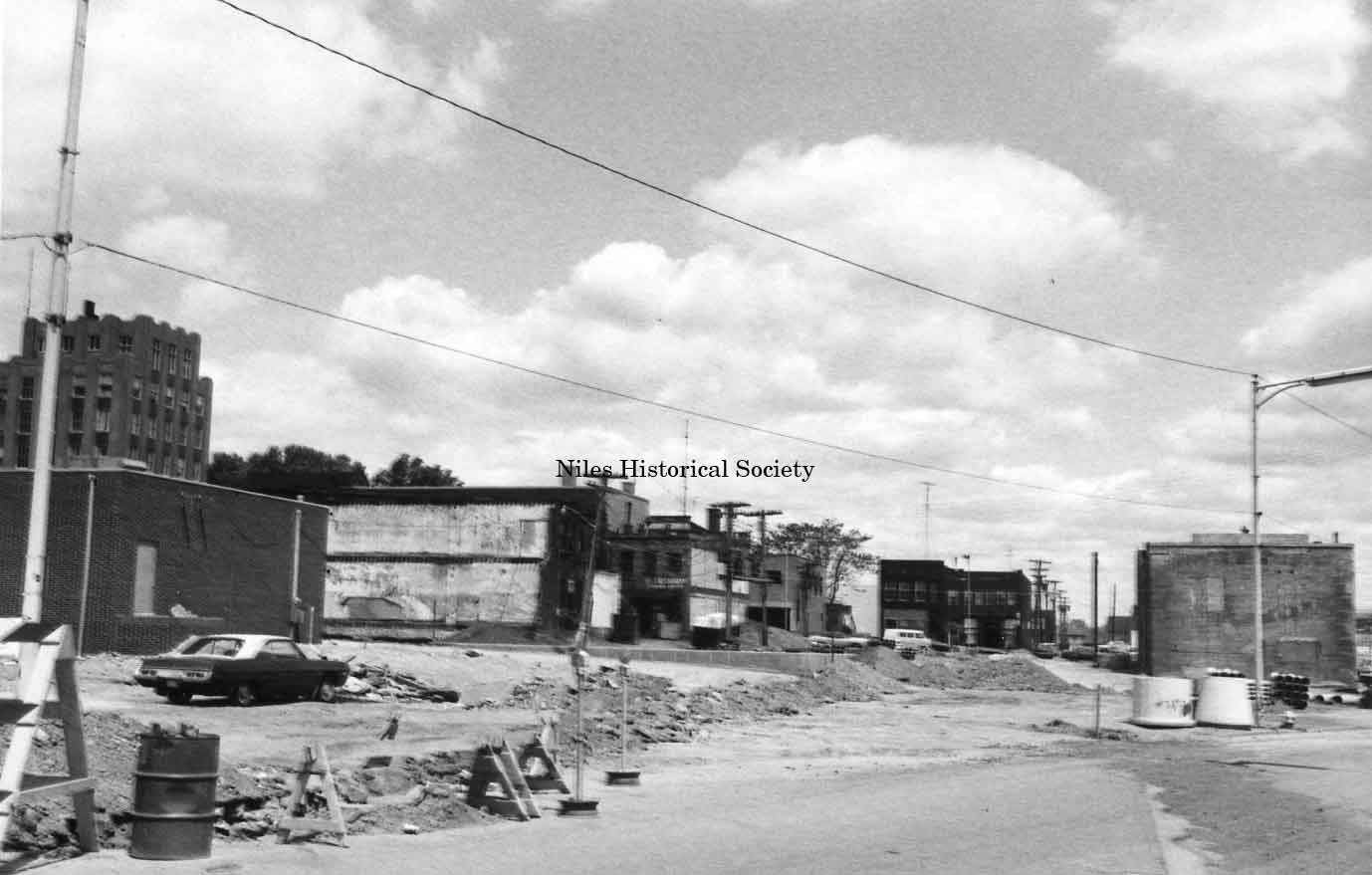
In 1976, work under the Federal Urban Renewal Program began to transform the downtown area as buildings built in the late 1870s - 1950s were demolished. The Niles City Police and Fire Departments were relocated to the new Niles City Municipal Building on State Street which included a new jail and Municipal Court facilities. With the demolition of the buildings on State Street, the street itself was moved east closer to Mosquito Creek providing additional space between North Main Street and East State Street. A new one-way street between East State Street and East Park Avenue provides access to downtown buildings and egress for fire department trucks going out on a call. Except for the west side of Main Street, no buildings predating 1910 remain in the downtown area. The following graphic photographs were taken to illustrate the condition of the buildings on State Street, East Park Avenue, and Main Street. The images were used in the application for Federal funds to demolish old buildings so that modern business facilities could be constructed. |
|
|
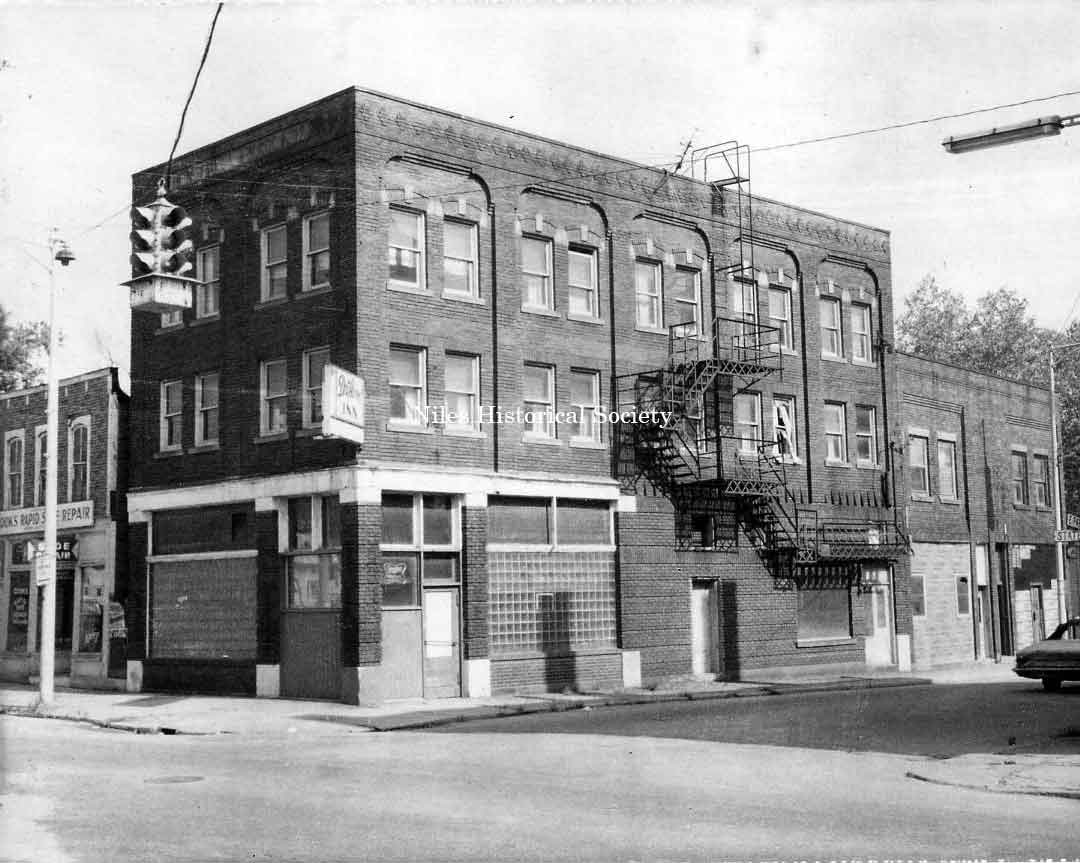
The Commercial Hotel, built in 1917,
located 117 East State Street (south side) in |
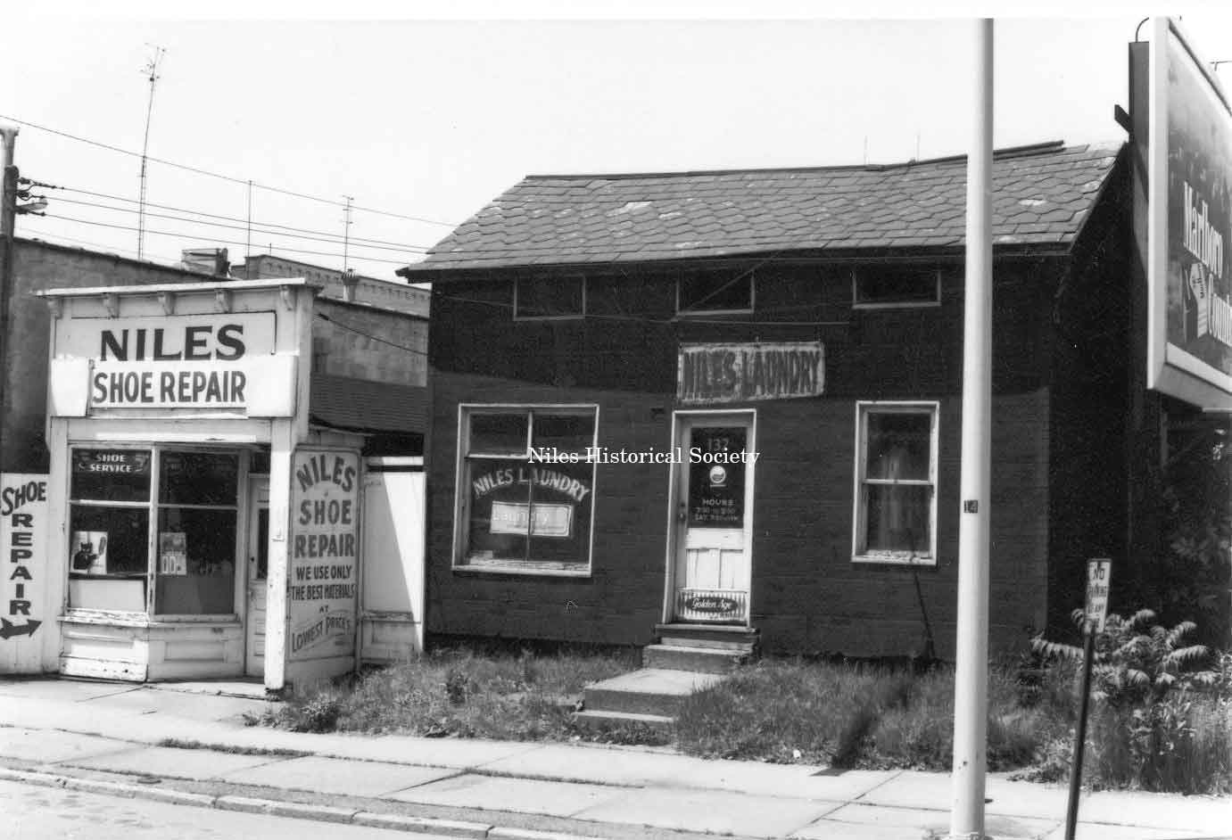
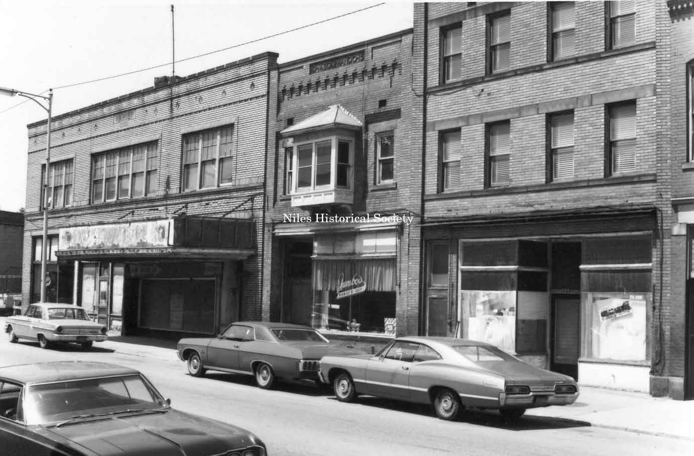
Photo taken of Niles Shoe Repair and Niles Chinese Laundry located at 130 and 132 East State Street in downtown Niles before urban renewal. Dated June 7, 1972 PO1.155 |
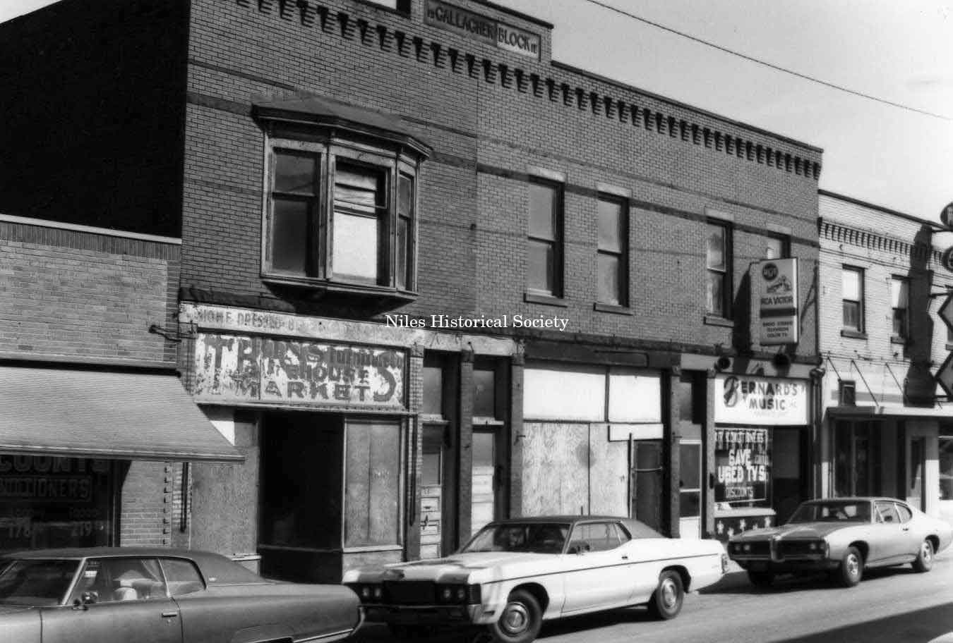
Photo of building located at 85 East State Street in down town Niles before urban renewal. Bernard Music is located in right hand corner of picture. Dated June 7, 1972 PO1.149 |
| |
||
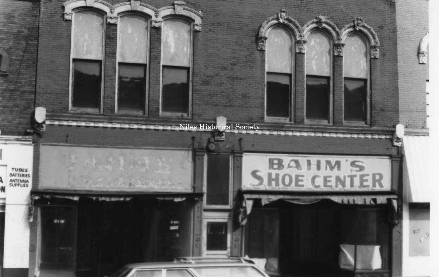
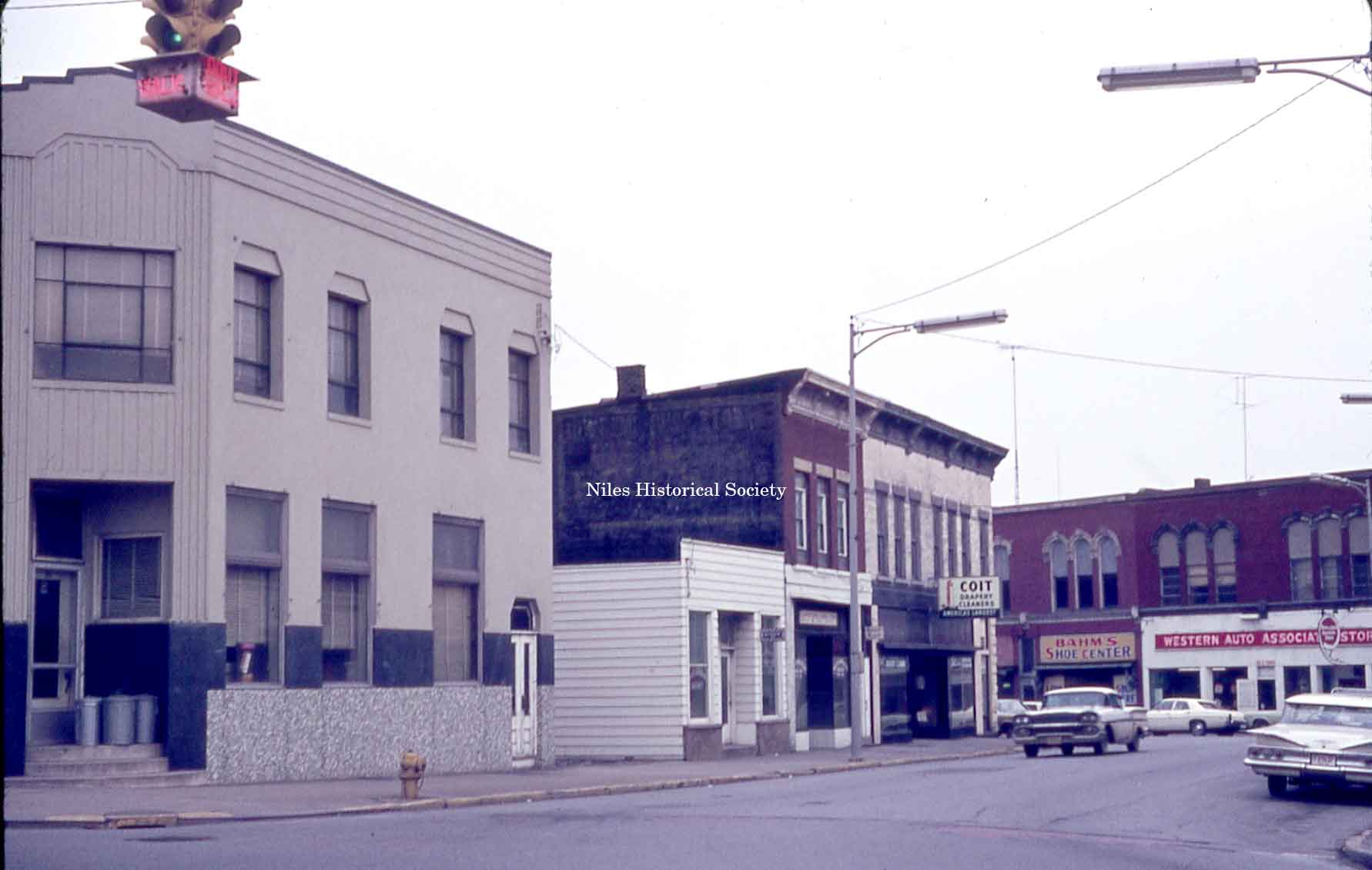
Photo taken of the Bahm Shoe Center located at 43 East State Street, Niles. Formerly a department store. PO1.126 |
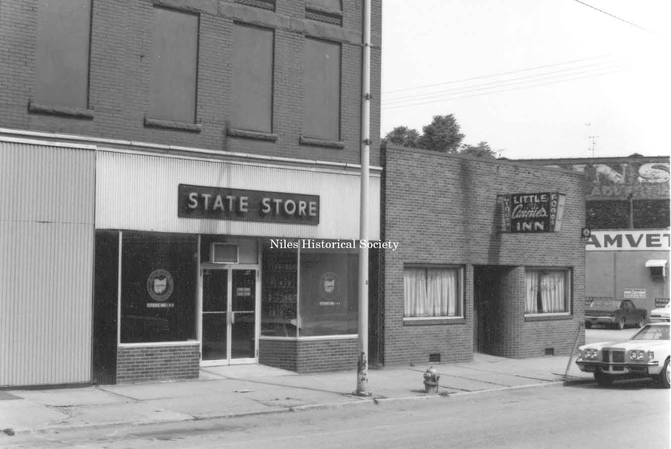
The State Liquor Store, Little Annies’ Inn and Amvets were located on the west side of State Street. PO1.95 |
Photo taken of the north side of East State Street with Jensen’s Hardware on the west or inside of bend on State Street. PO1.166 |
|
|
||
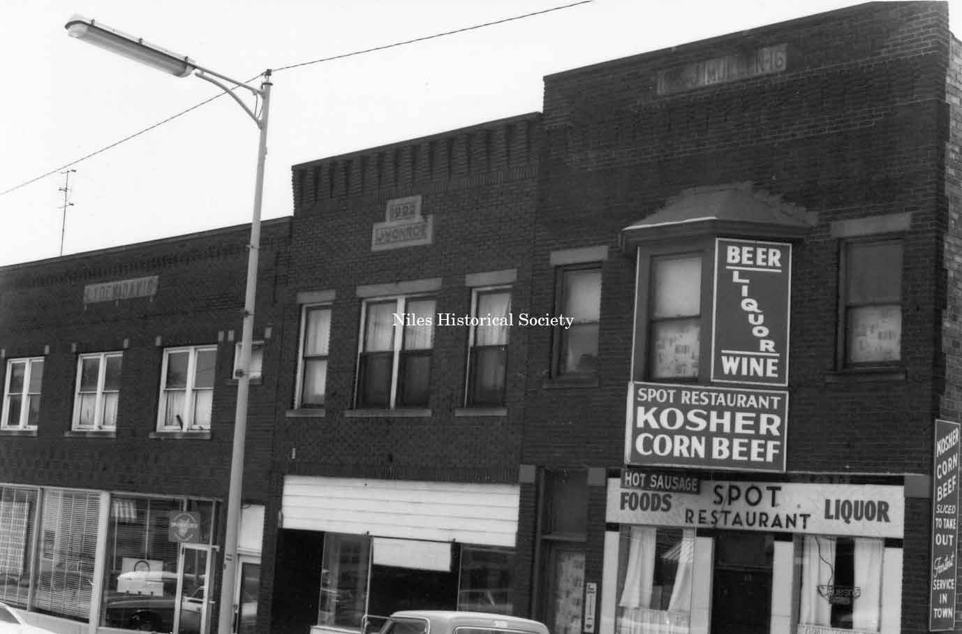
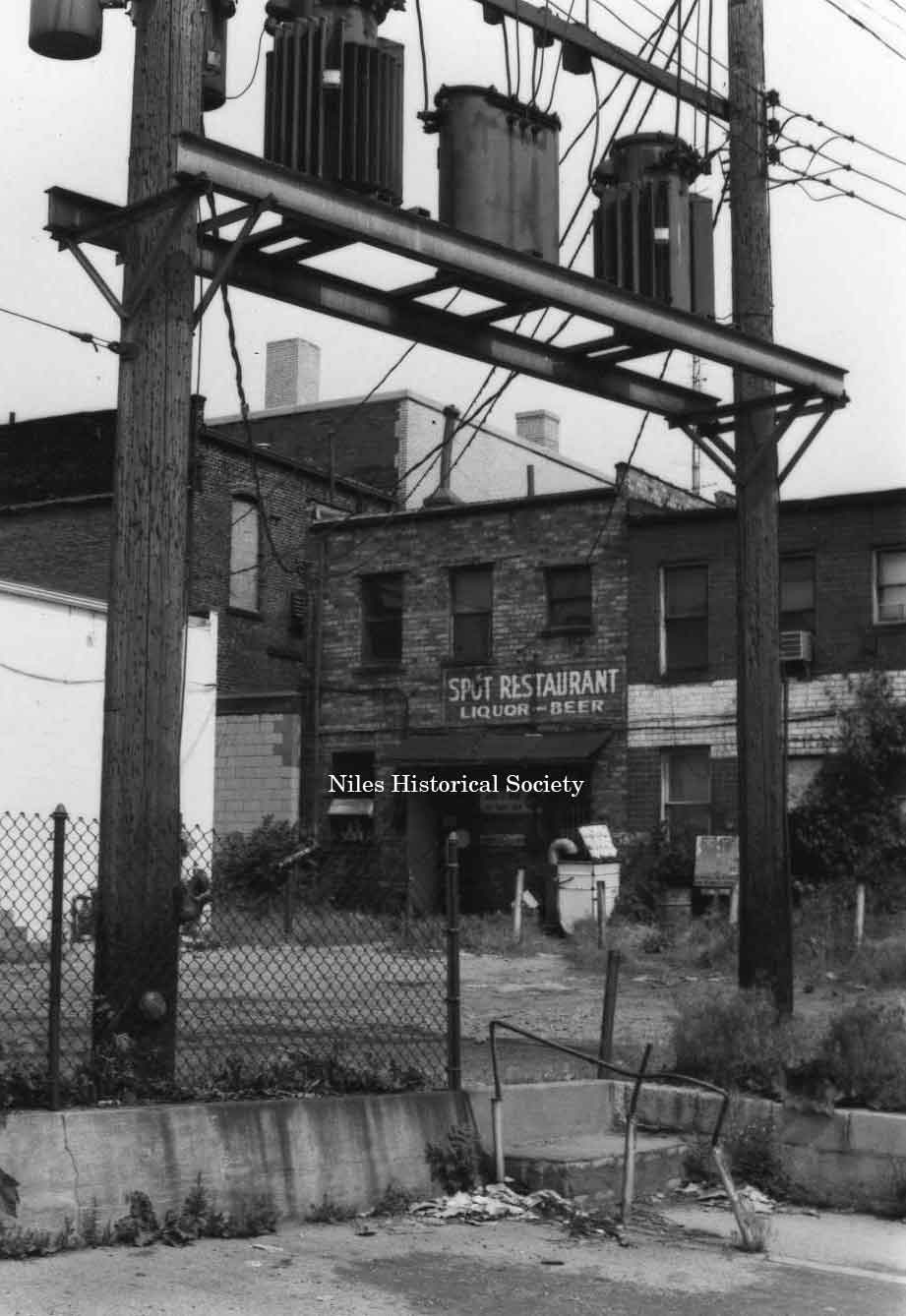
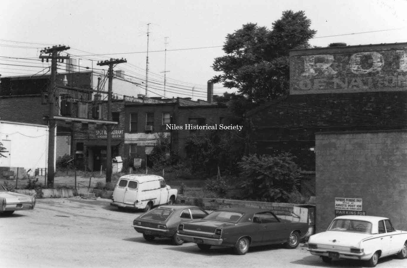
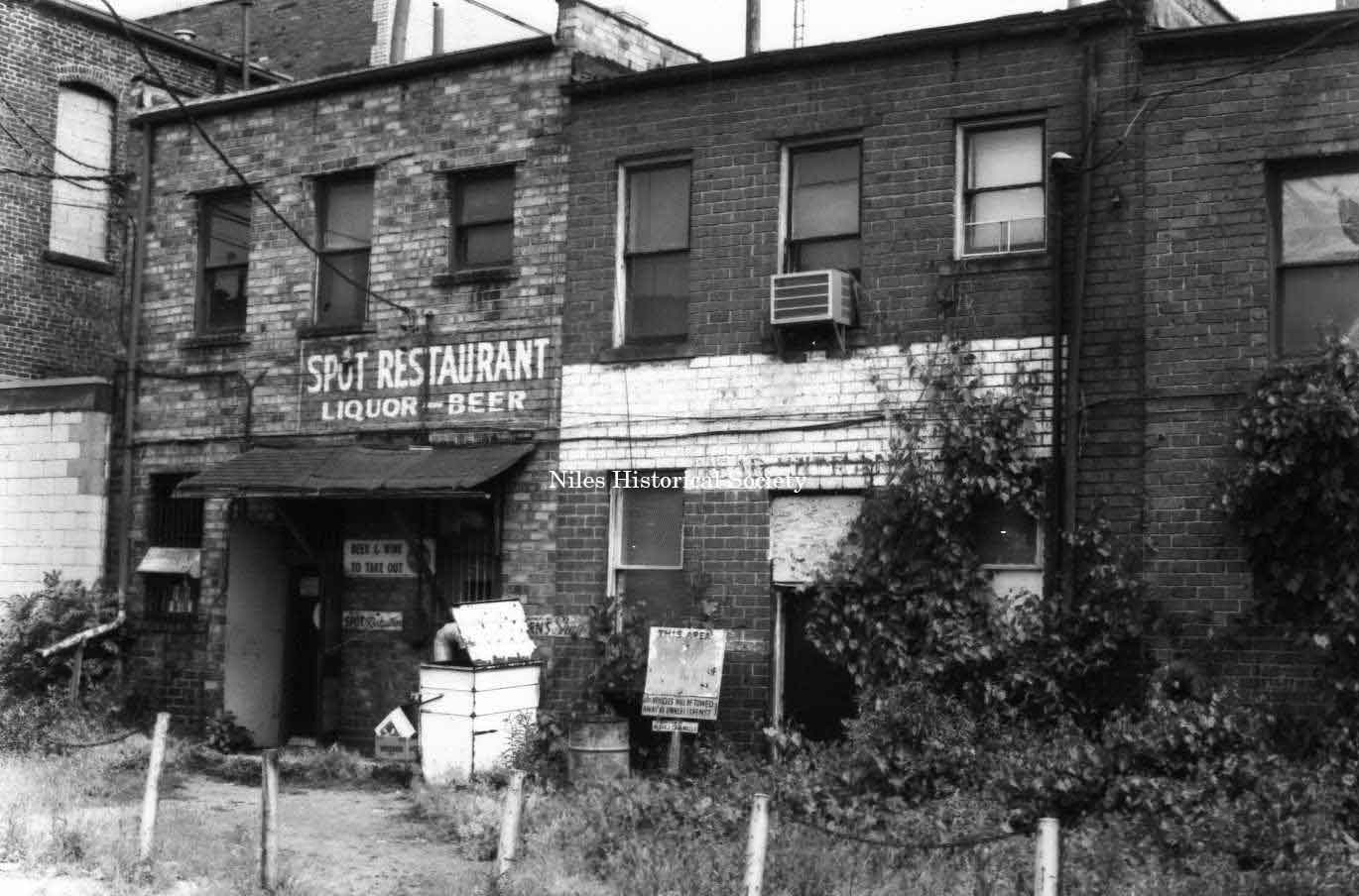
Photo taken of The Spot Restaurant located at 13 East Park Avenue (south side) in downtown Niles before the advent of urban renewal. PO1.173 |
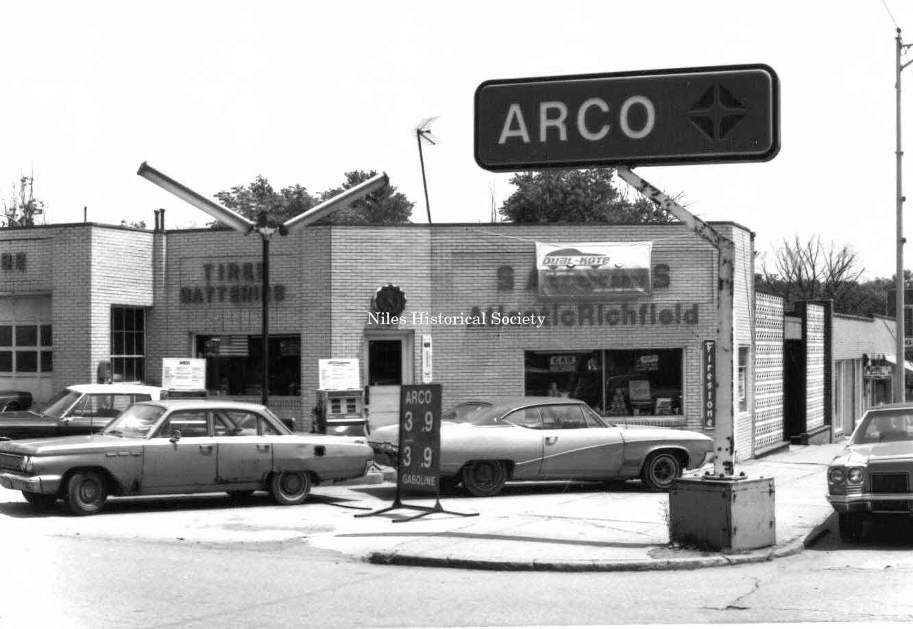
Picture taken of Sam Bernard’s
gas station located at 32 East Park Avenue(north side) |
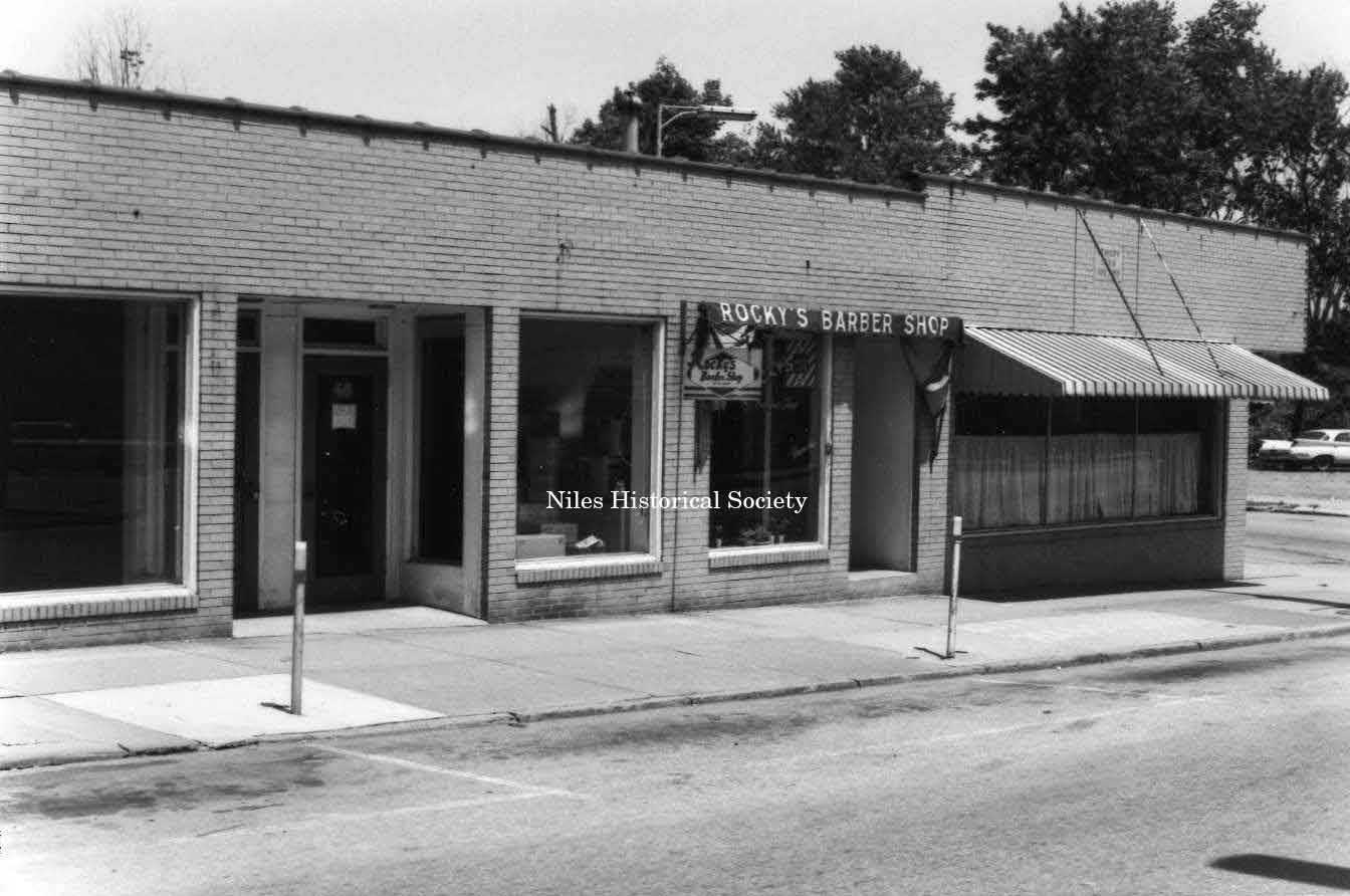
Picture taken of Rocky’s Barbershop located at 50 East Park Avenue in downtown Niles before urban renewal. PO1.144 |
| |
||
| Main
Street and Miscellaneous Buildings |
||
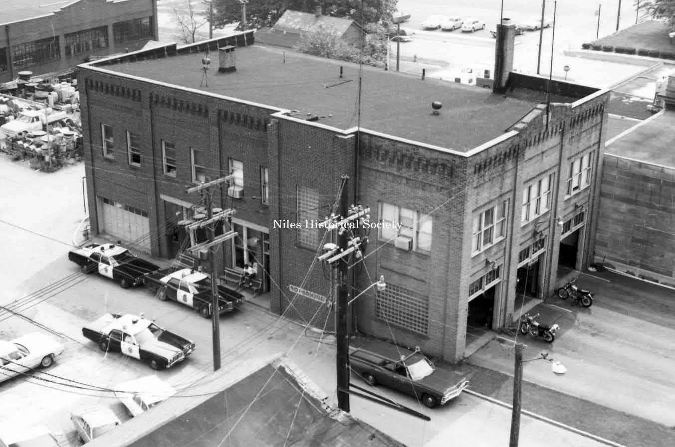
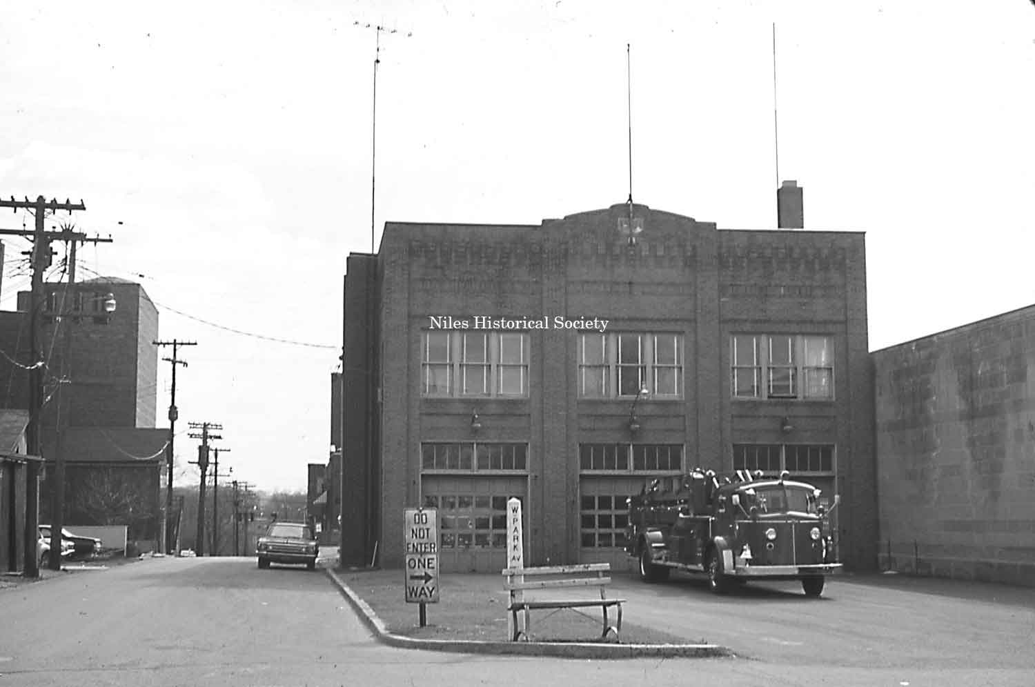
Photo taken of the old Police and
Fire Station built in 1889 located on the east side of the Post
Office, on West Park Avenue in downtown Niles before urban renewal.
PO1.178 |
Front view of the old Police and Fire Station from West Park Avenue and Franklin Alley. Originally the City Building, it was enlarged for the Police and Fire departments in 1931. S11.168 |
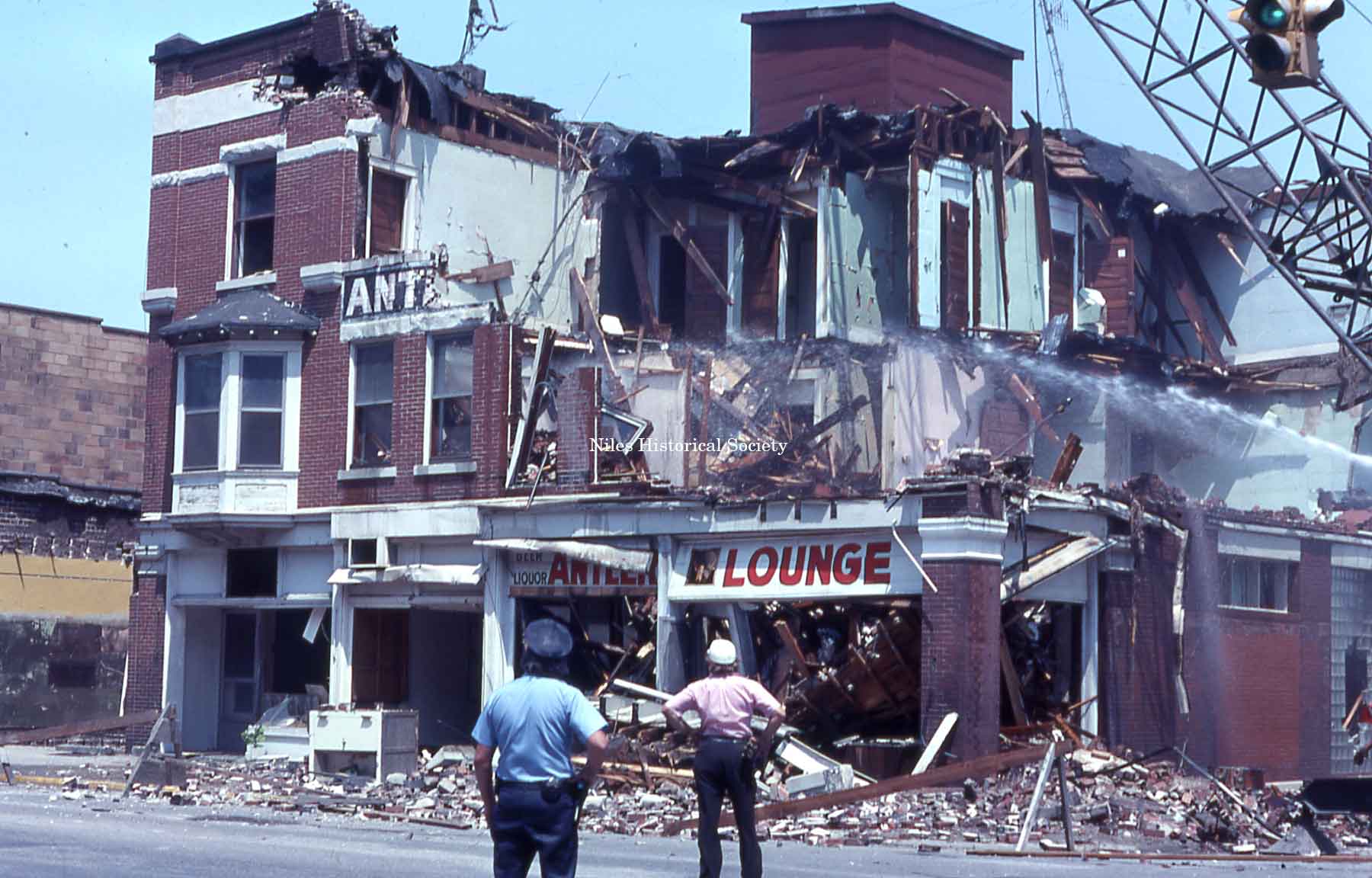
The final stages of the demolition
of the Antler Hotel on the northeast corner of Main Street and
East Park Avenue. Dated June 1976.
SO3.83a |
|
|
||
|
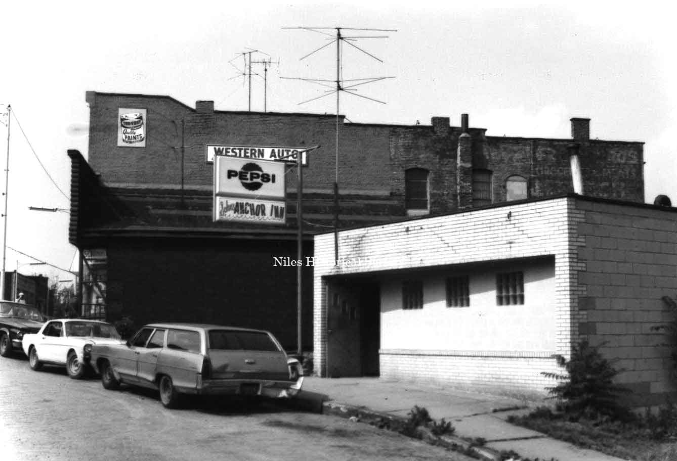
Photo taken of the Anchor Inn and the Western Auto buildings on the south side of East State Street in Niles. PO1.118 |
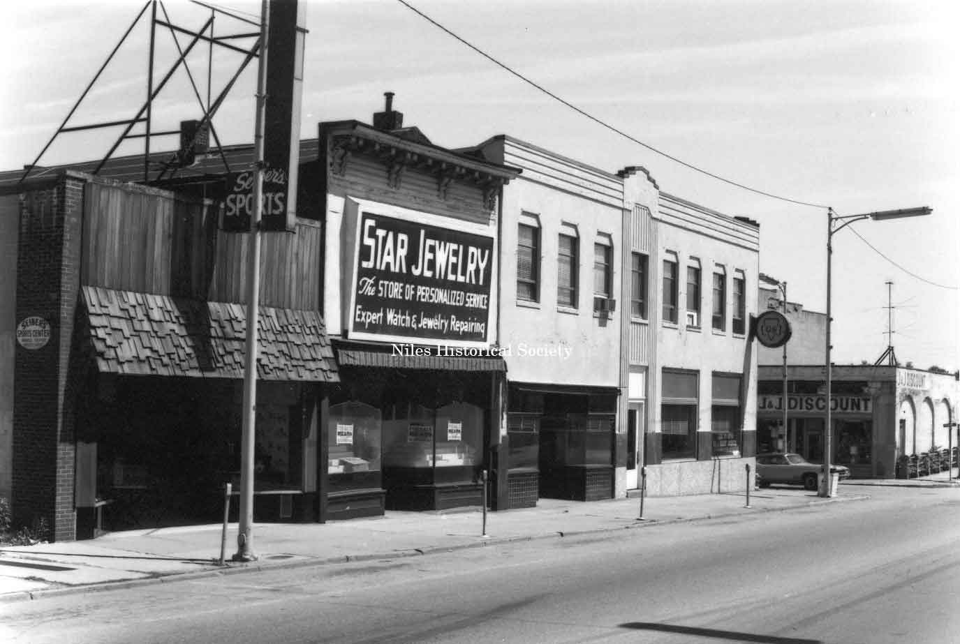
Photo taken of Star Jewelry and Seiber’s Sporting Goods located on the east side of Main Street in downtown Niles before urban renewal. PO1.171 |
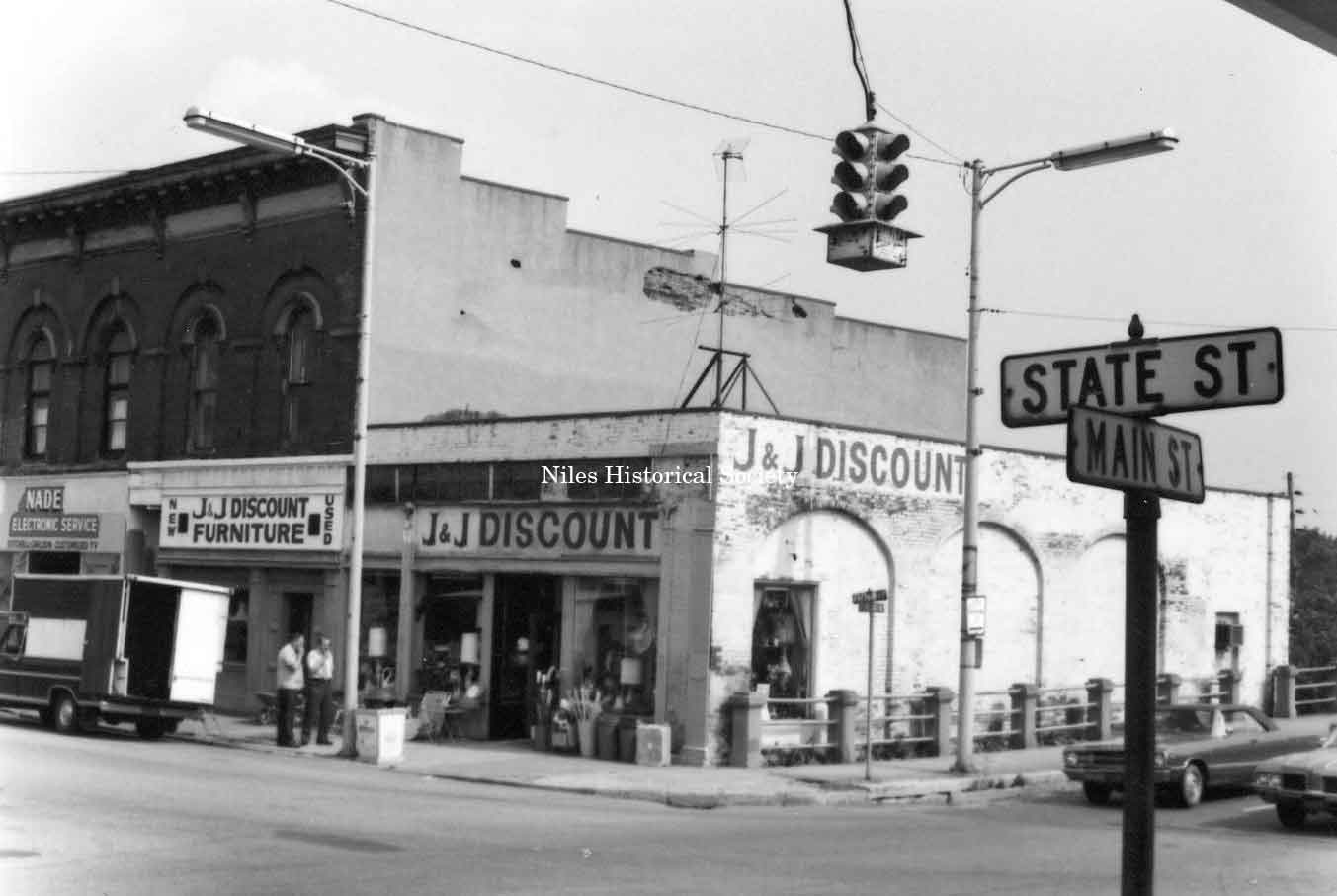
Photo taken of J & J Discount Store on the southeast corner of Main and State Streets in downtown Niles before urban renewal. PO1.157 |
|
|
||
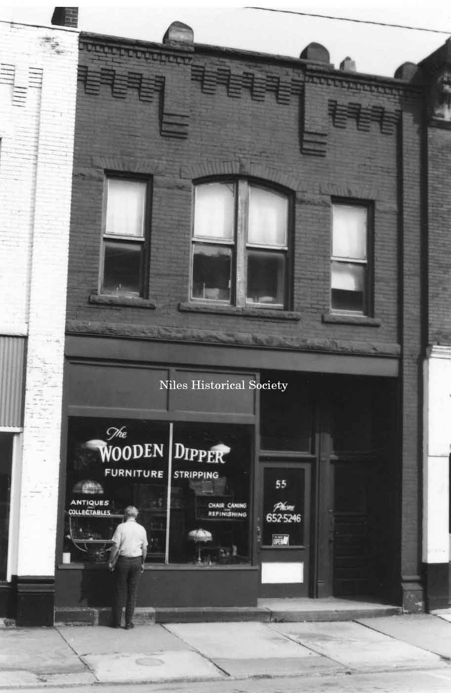
Photo taken of The Wooden Dipper at 55 East State Street in down town Niles before urban renewal. PO1.158 |
Photo taken of the Landmark Bar |
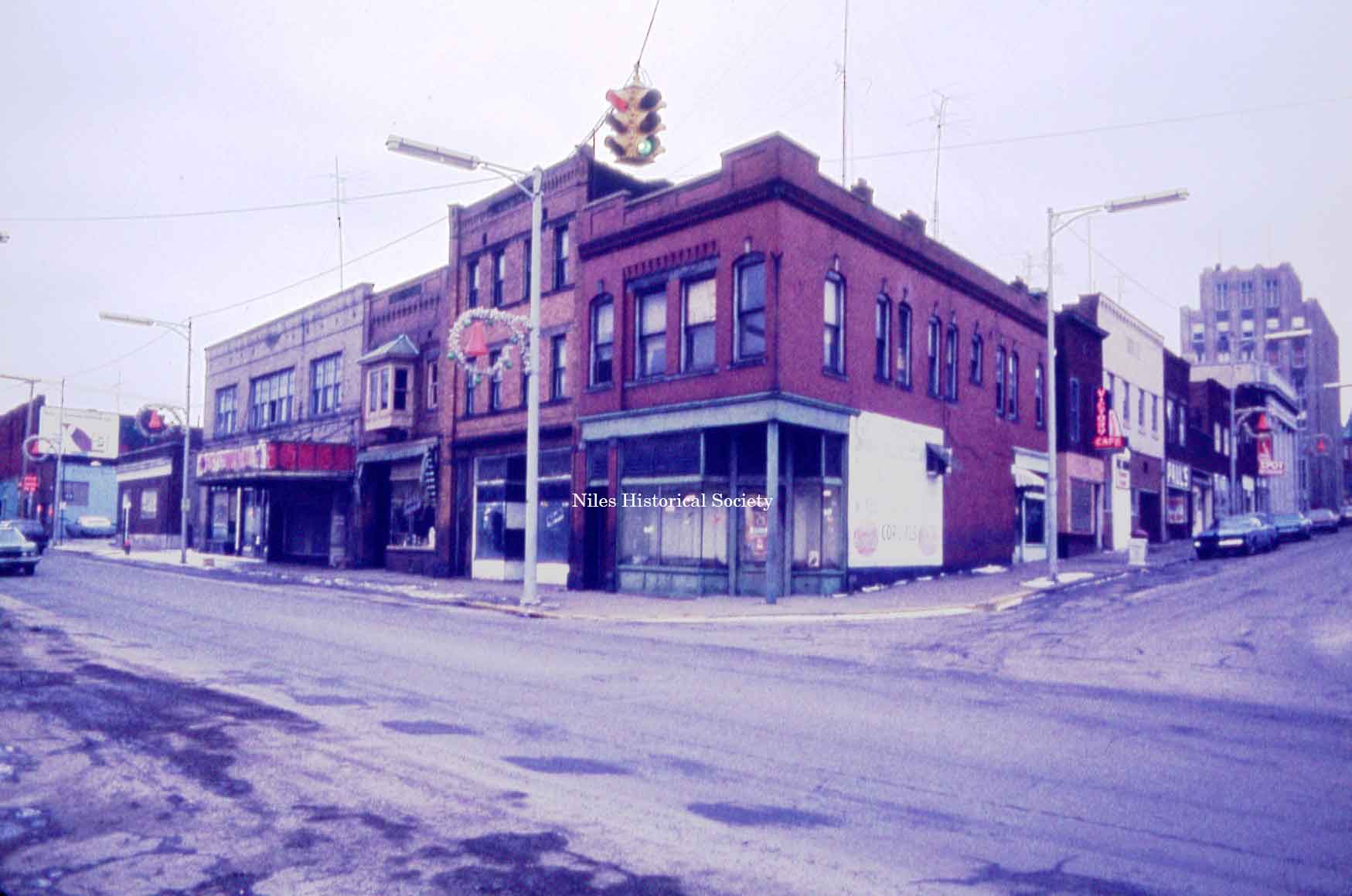
Photo of the corner of East Park Avenue and East State Street in downtown Niles. PO1.298
North side of East State Street at South Main Street. S11.317 |
|
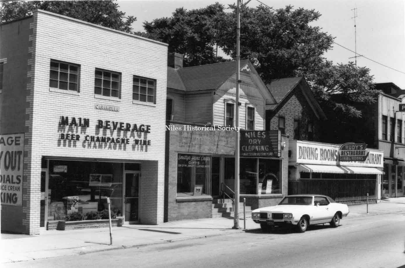
Photo taken of Main Beverage located at 31 North Main Street, Niles Dry Cleaners, Rudy’s Restaurant, Pugh Hardware in downtown Niles before urban renewal. PO1.163 |
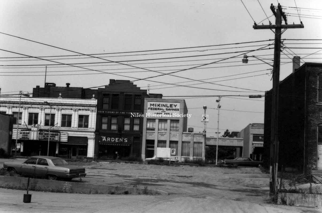
Photo taken of McKinley Federal Savings and Loan, and the Arden Building, (also The Old Main Ale & Chowder House) located on the site of the McKinley home in downtown Niles before urban renewal. The Arden building and the bank have been razed to make way for the replica of the McKinley Birthplace. PO1.172 |
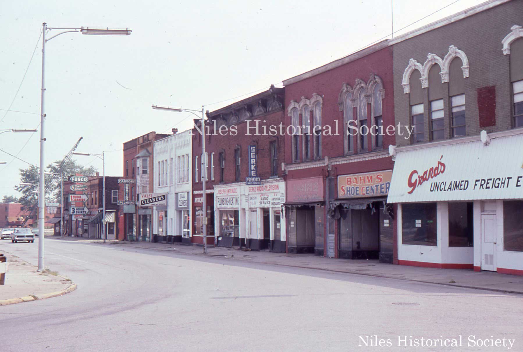
Looking north from the curve on East State Street. Grand’s Unclaimed Freight, Bahm’s Shoe Center, Gerke Radio & Television, Joe Antenucci Plumbing, Antique Shop, Valsi Cleaners, Lou Carbone Plumbing, and Fusco Dry Cleaners. All these buildings were demolished during urban renewal. PO11.6 |
|
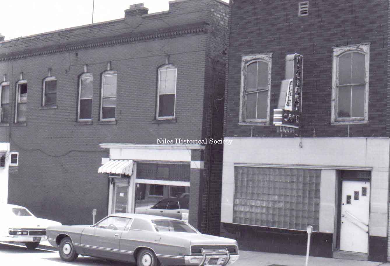
Photo taken of 39 East Park Avenue, Niles. This building is the Victory Cafe. PO1.116 |
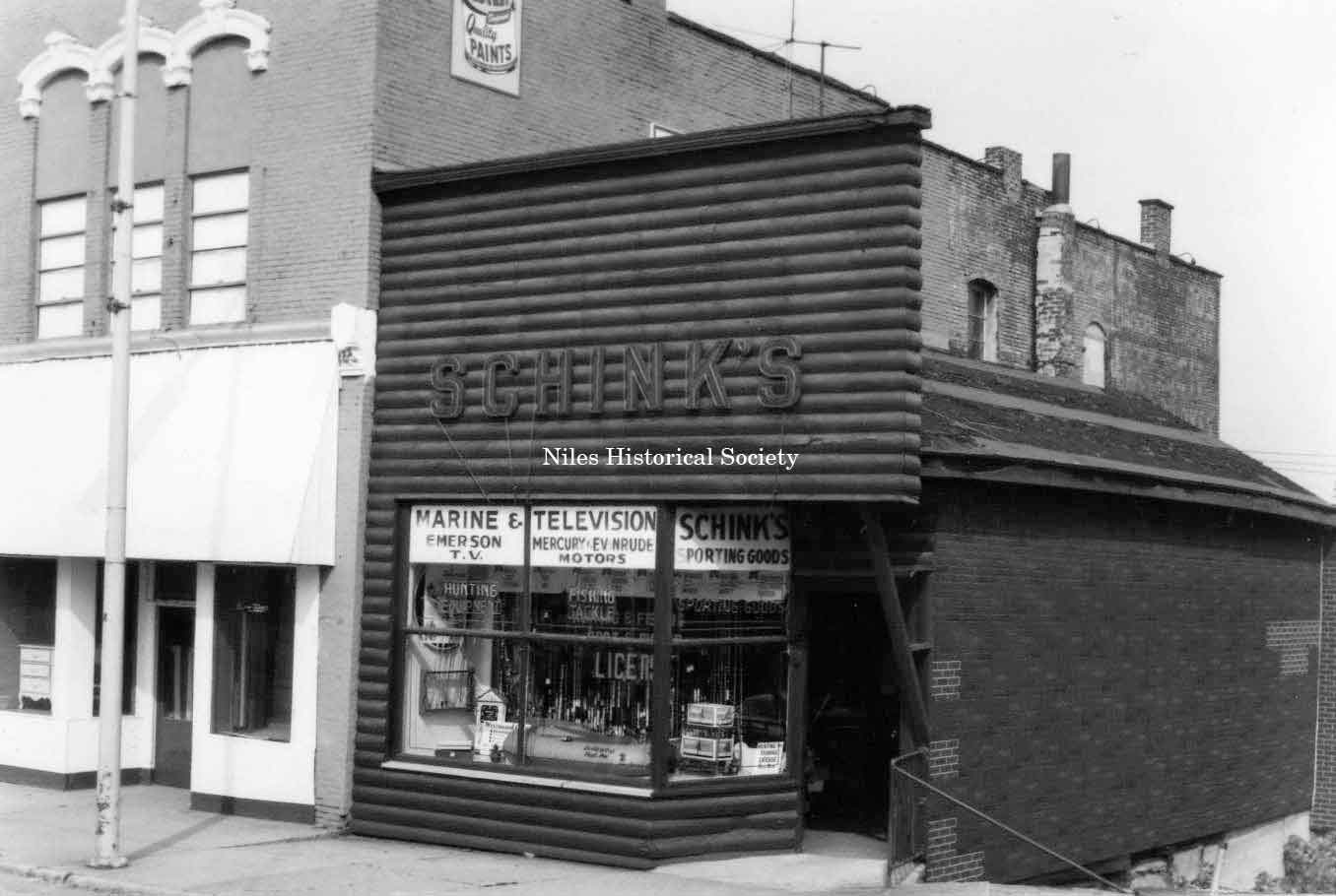
Photo taken of Schink's Marine and T.V. located at 33 East State Street (east side) in down town Niles before urban renewal. PO1.148 |
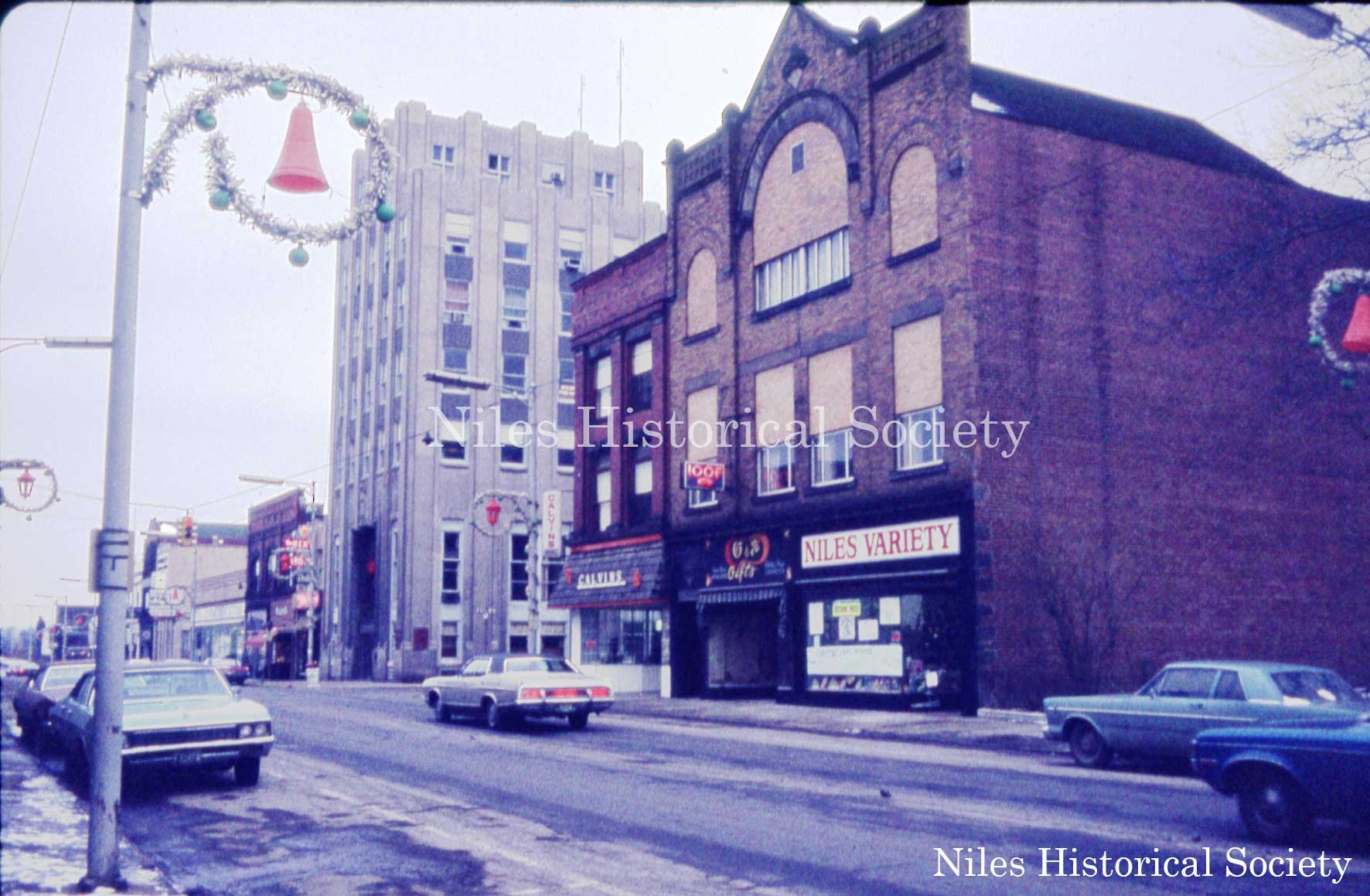
View of the IOOF Building and Calvin's Drug Store at corner of North Main Street and West Park Avenue. These two buildings were the last to be demolished in January 1990. S11.265 |
|
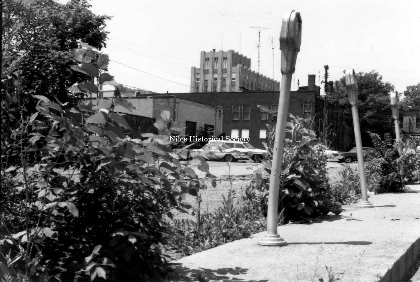
Photo taken of parking meters used
in the |
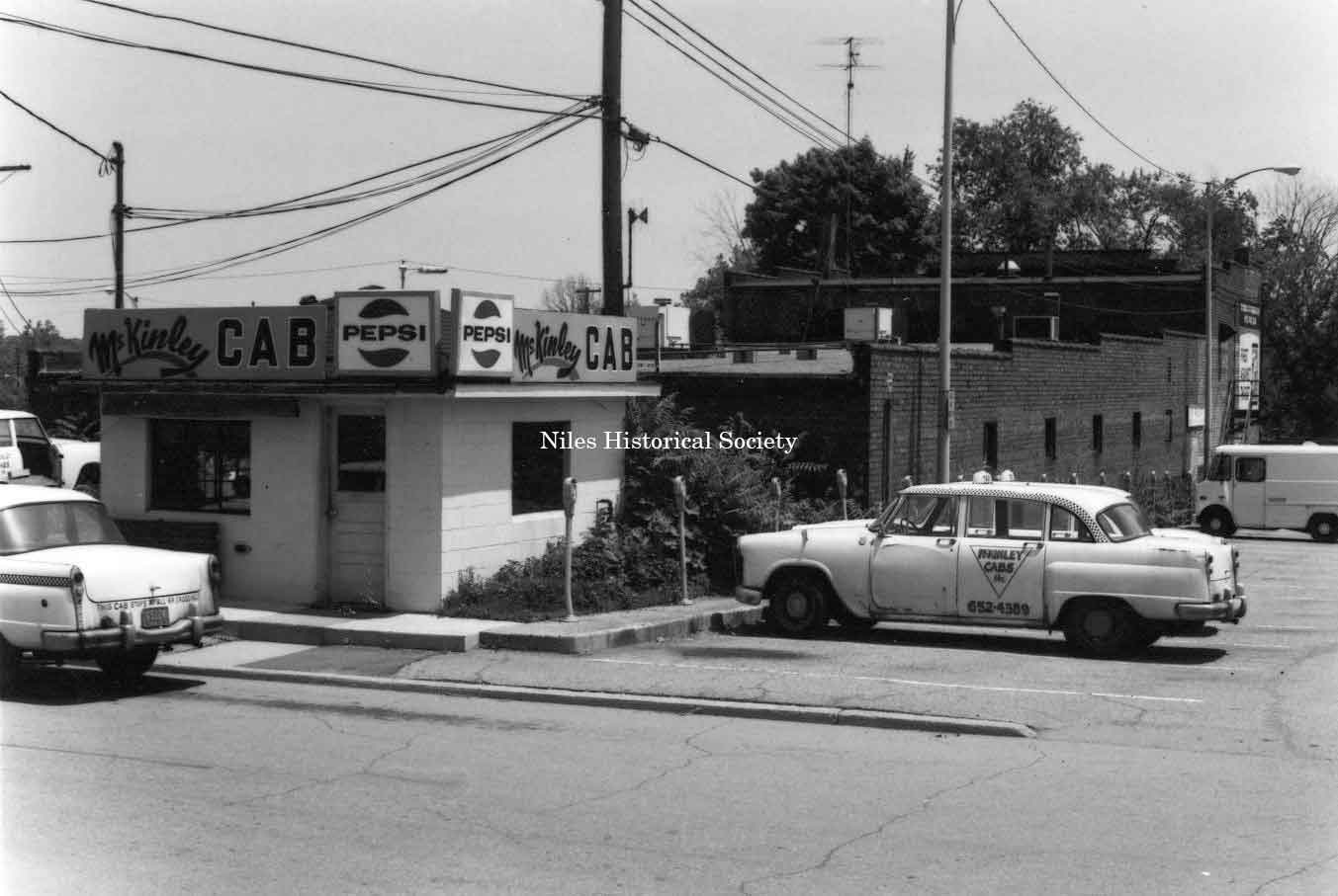
Photo taken of the McKinley Cab Company located at 449 Pine Alley in downtown Niles before urban renewal. PO1.159 |
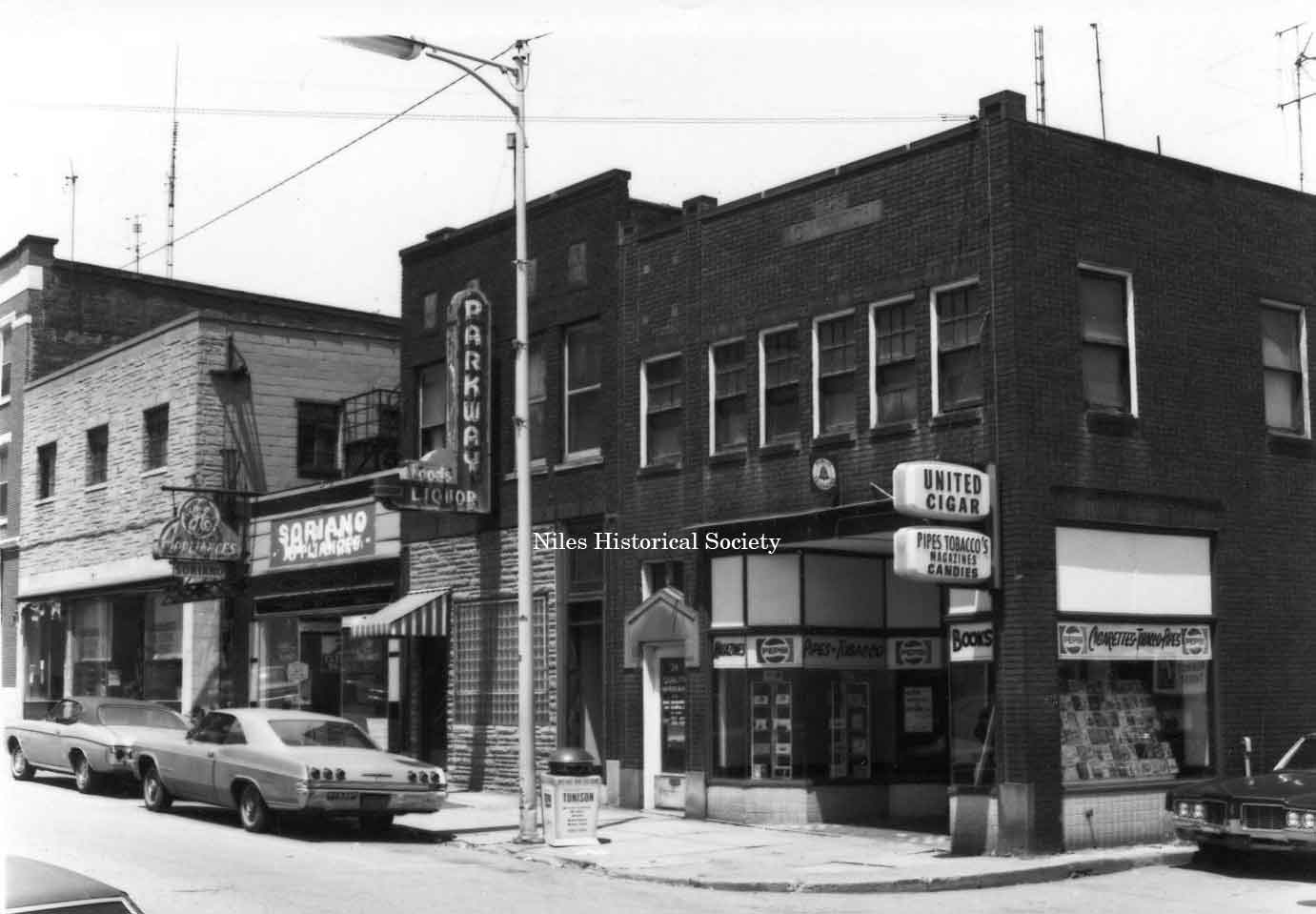
Photo taken of The United Cigar located at 28 East Park Avenue on the corner of Park and Pine Alley in downtown Niles before urban renewal. PO1.174 |
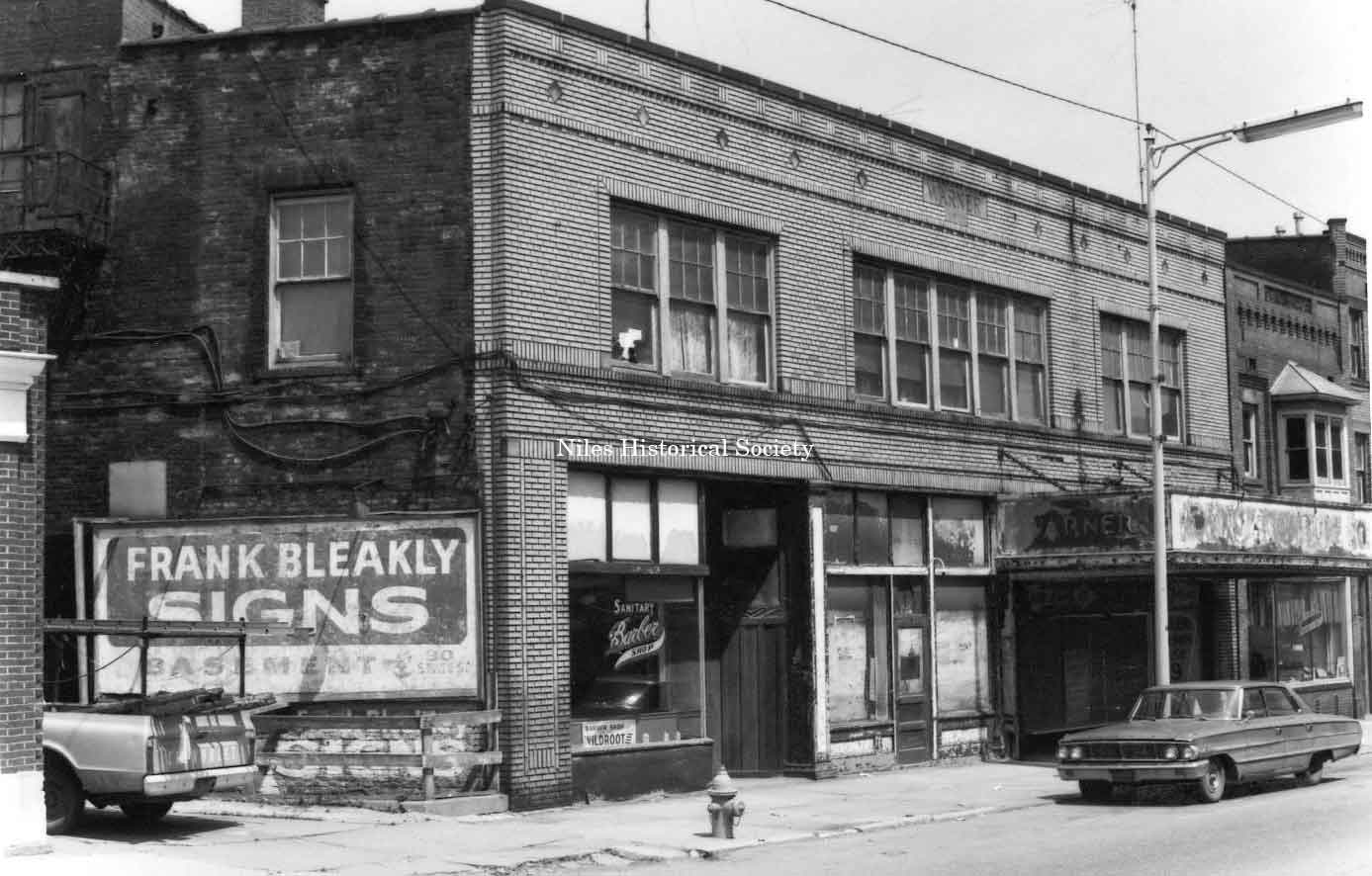
Photo taken of Frank Bleakley’s Sign Company in the basement of the old Warner Theatre Building on State Street. PO1.165 |
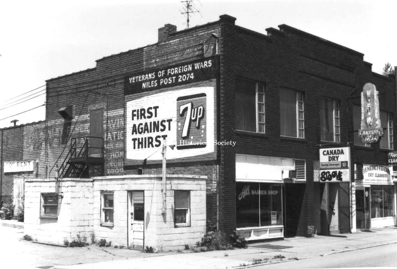
Photo taken of the old bowling alley, 162 East State Street, down town Niles. The Veteran's of Foreign Wars are located upstairs. Note also Benedict Dry Cleaners next door and The Groove dancing lounge. PO1.194 |
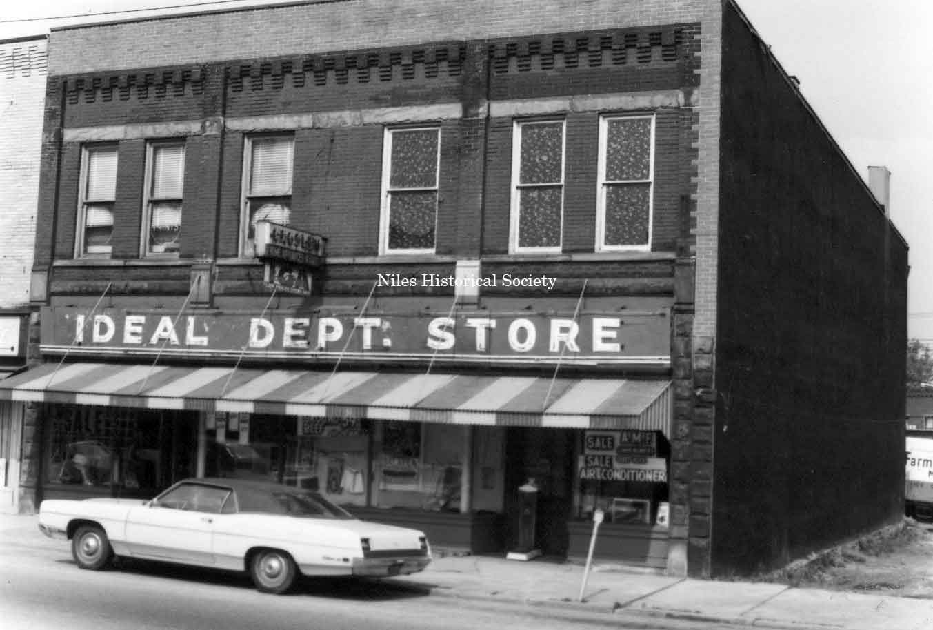
Photo taken of the Ideal Deptartment Store located on the east side of South Main Street in downtown Niles before urban renewal. PO1.169 |
|
|
||
 |
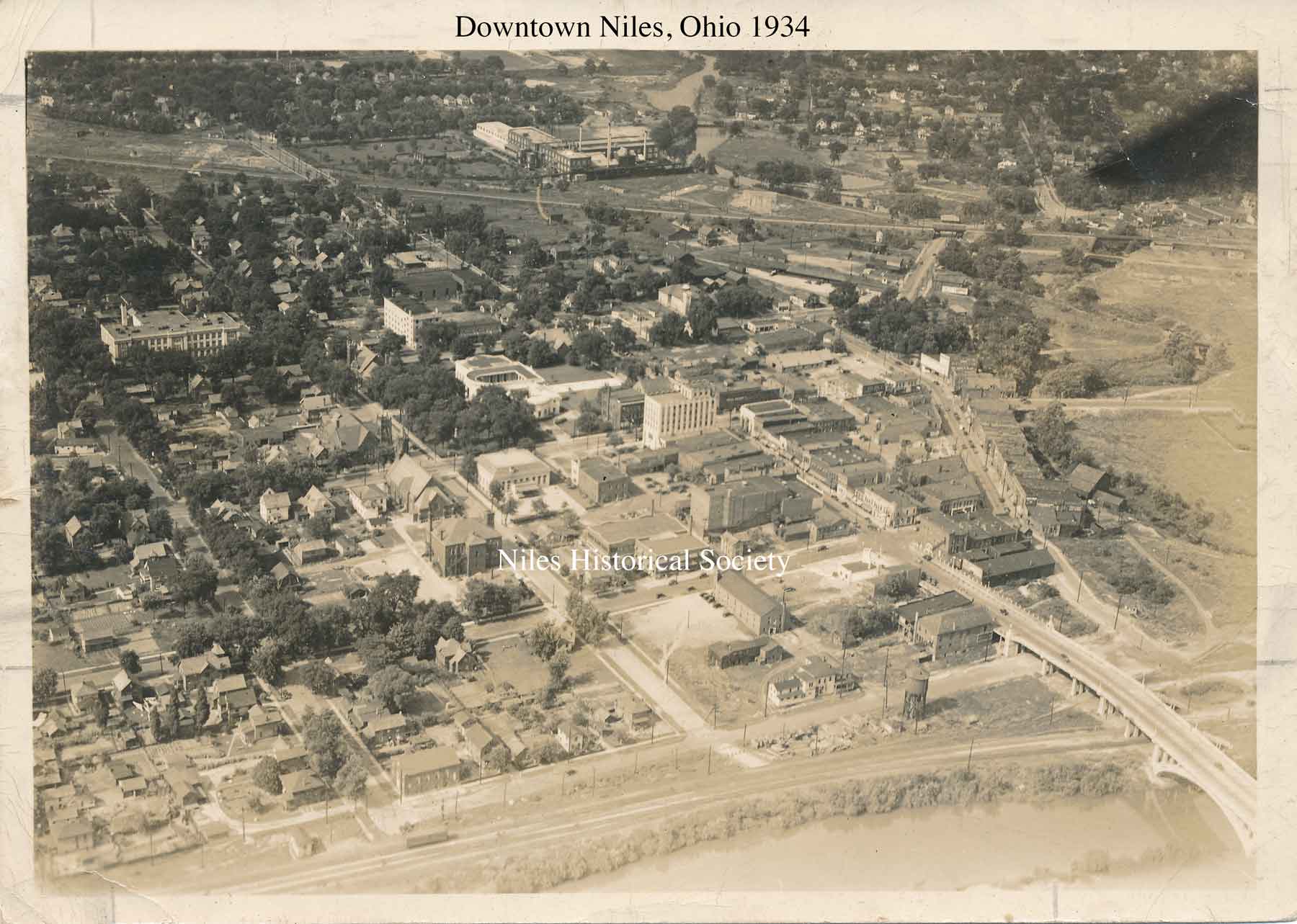
Many of the brick buildings on East State Street and South Main Street that were razed during urban renewal had been built before 1882 as shown in this panoramic map of Niles. The 1934 map of Niles shows the buildings when the downtown was filled with three movie theatres, many restaurants, jewelry stores, clothing stores for men and women, hardware stores, pool halls, and churches. |
 |
|
|
||
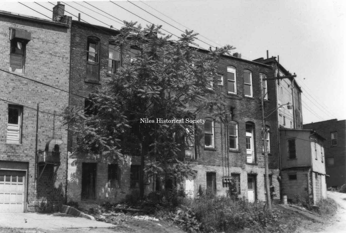
Photo taken of rear facade of unidentified building located on the east side of East State Street (over Mosquito Creek) in downtown Niles before urban renewal. PO1.193 |
Photo taken of rear facade of unidentified building located on the east side of East State Street (over Mosquito Creek) in downtown Niles before urban renewal. PO1.192 |
Photo taken of rear facade of unidentified building located on the east side of East State Street (over Mosquito Creek) in downtown Niles before urban renewal. PO1.140 |
|
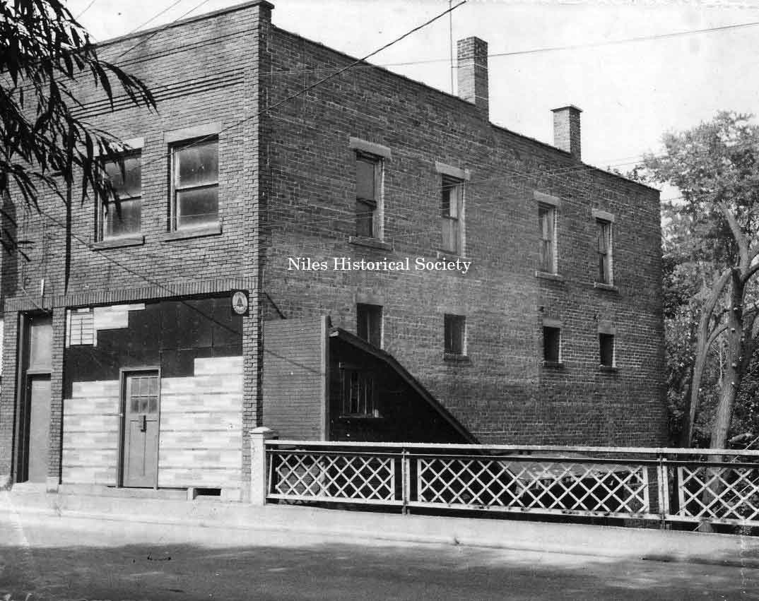
Photo taken of Commercial Hotel on East Park Avenue and East State Street in downtown Niles before urban renewal. PO1.180 |
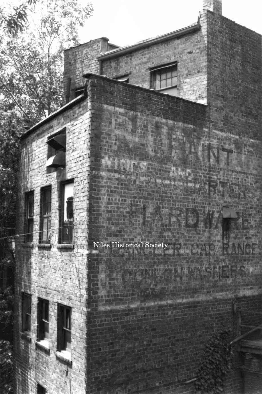
Picture of detail of rear façade
of |
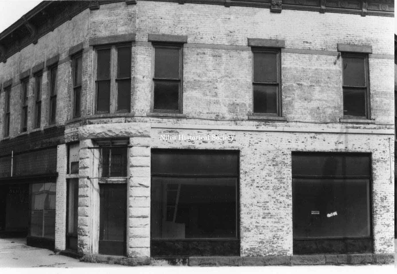
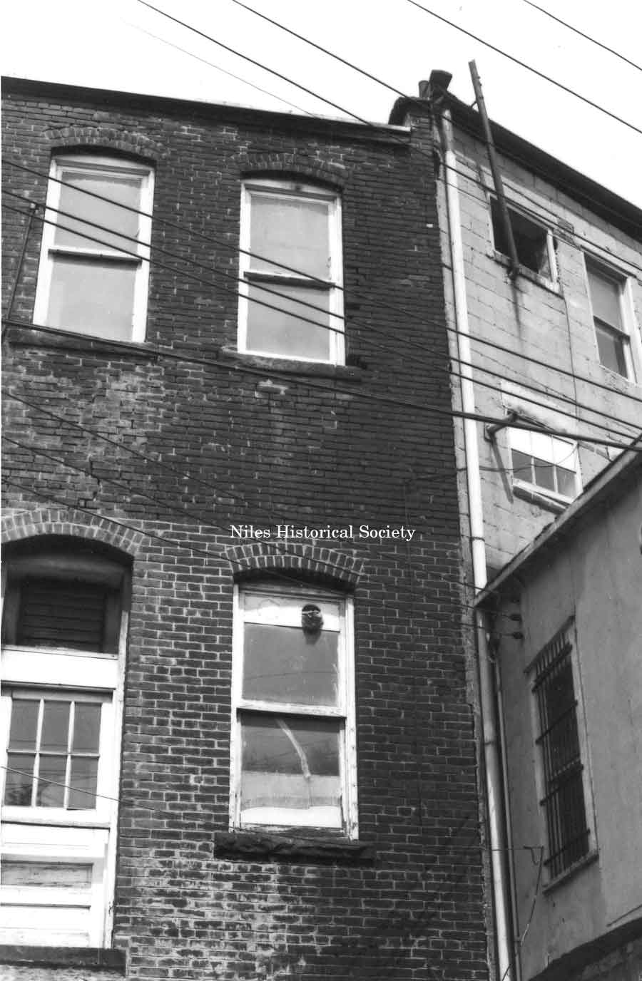
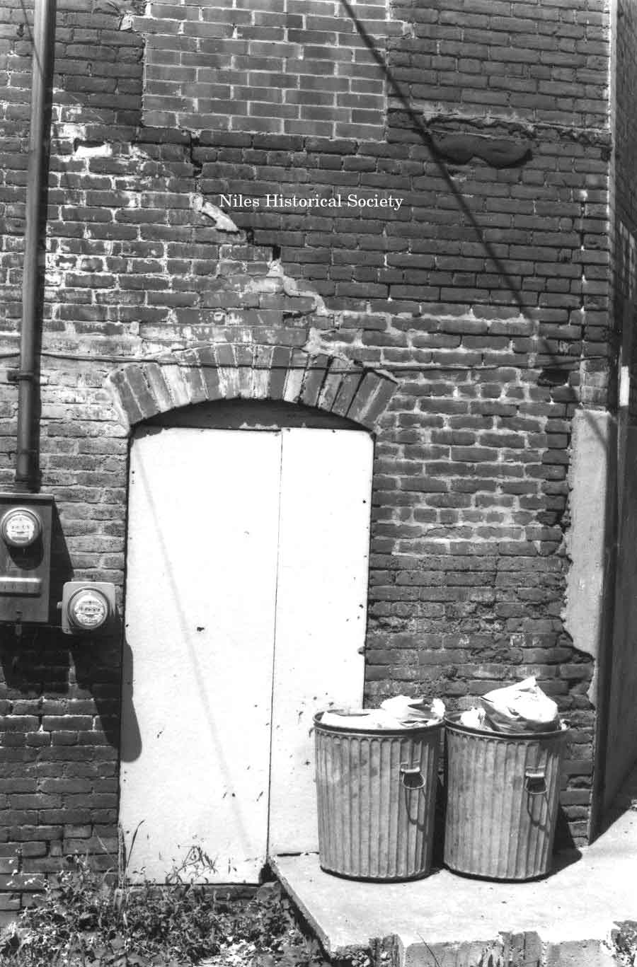
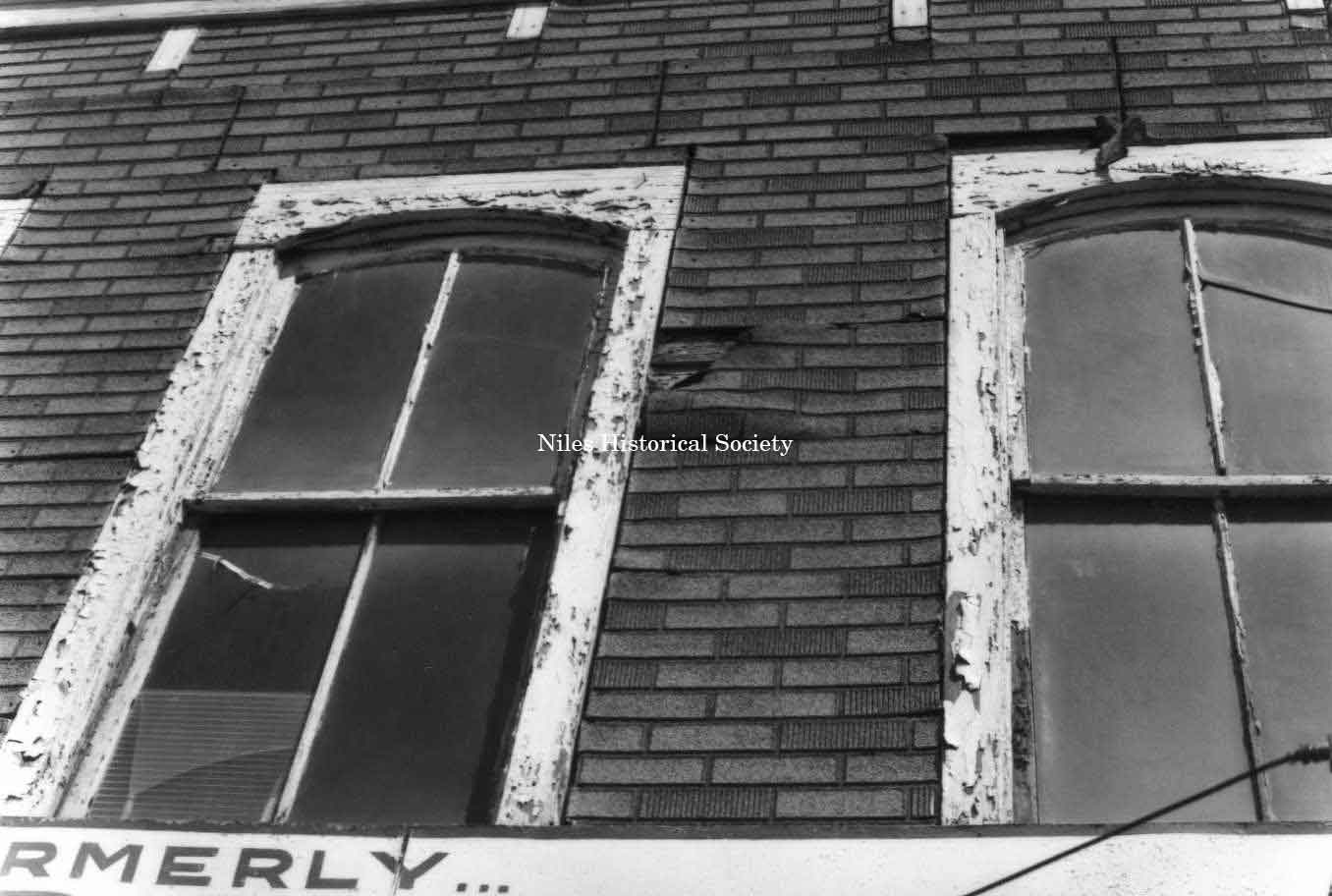
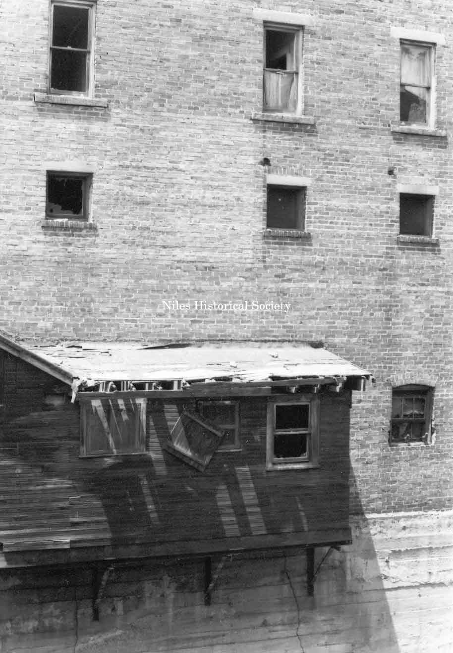
Photo taken showing marked deterioration on windows on building located in downtown Niles before urban renewal. PO1.130 |
|
|
||
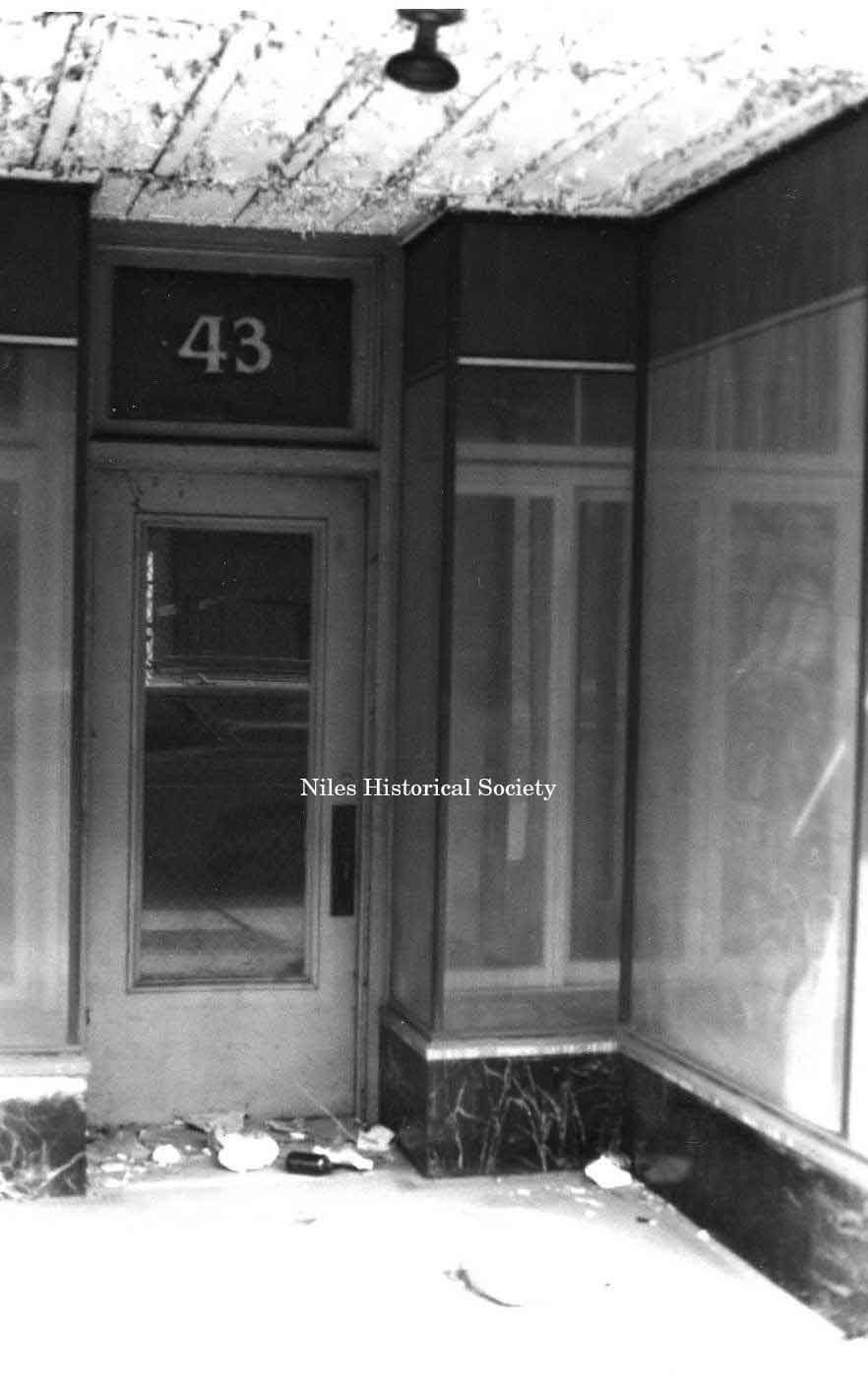
Photo taken of storefront detail located at 43 Main Street Niles. PO1.123 |
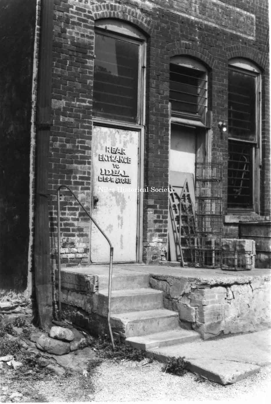
Photo of the rear entrance of the Ideal Dept. Store, located on Main Street, east side. PO1.101 |
Photo taken of the rear of the Spot Restaurant. View from Pine Alley. PO1.103 |
|
|
||
|
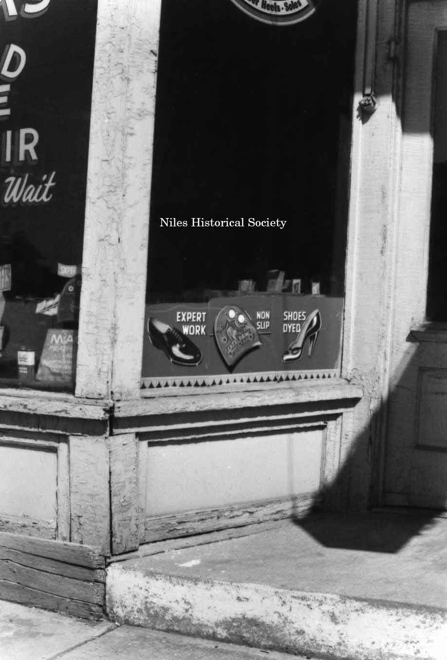
Photo taken of detail storefront of Cook’s Rapid Shoe Repair, located on East State Street. PO1.137 |
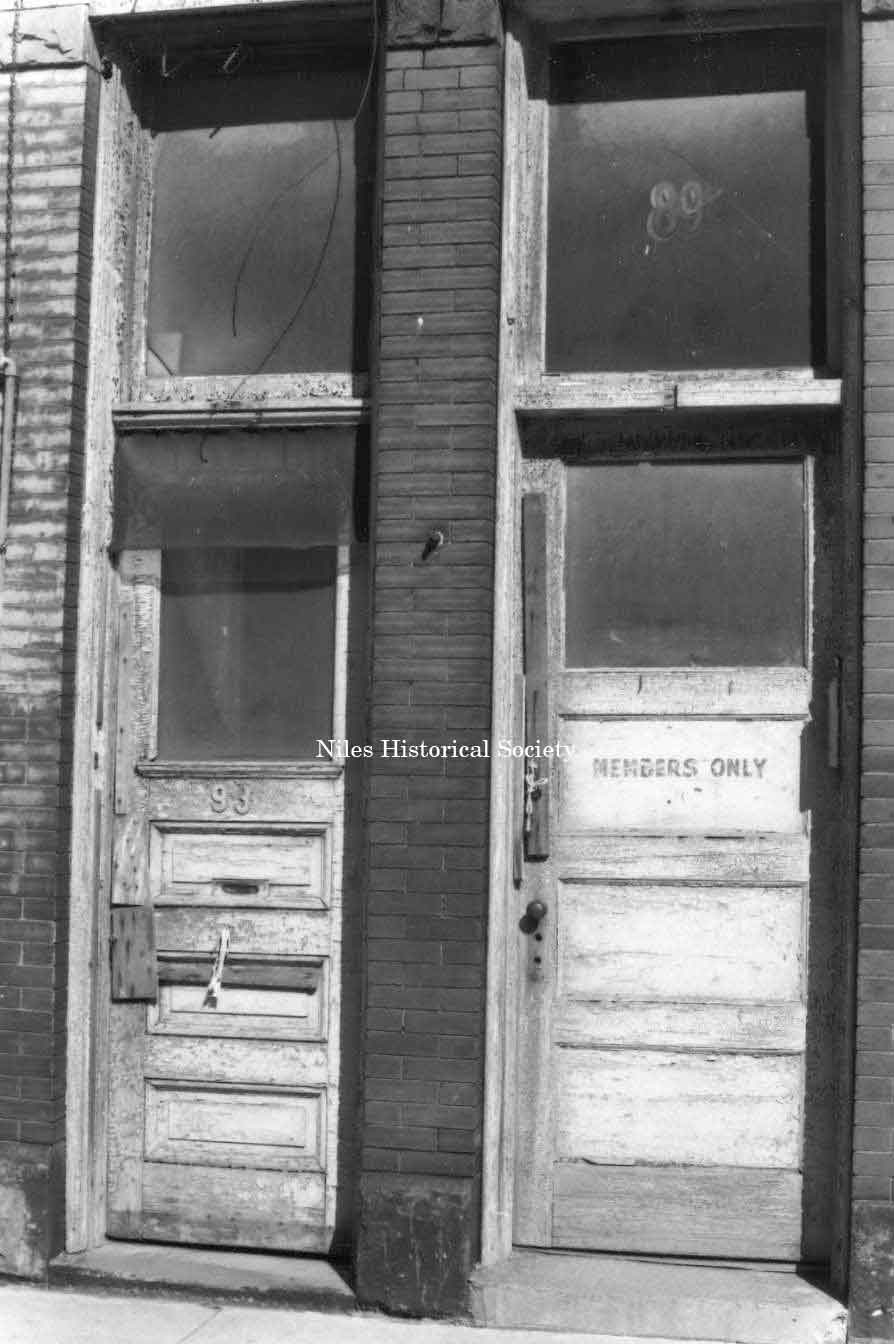
Photo taken showing marked deterioration on doors and other details on unidentified building in downtown Niles. PO1.131 |
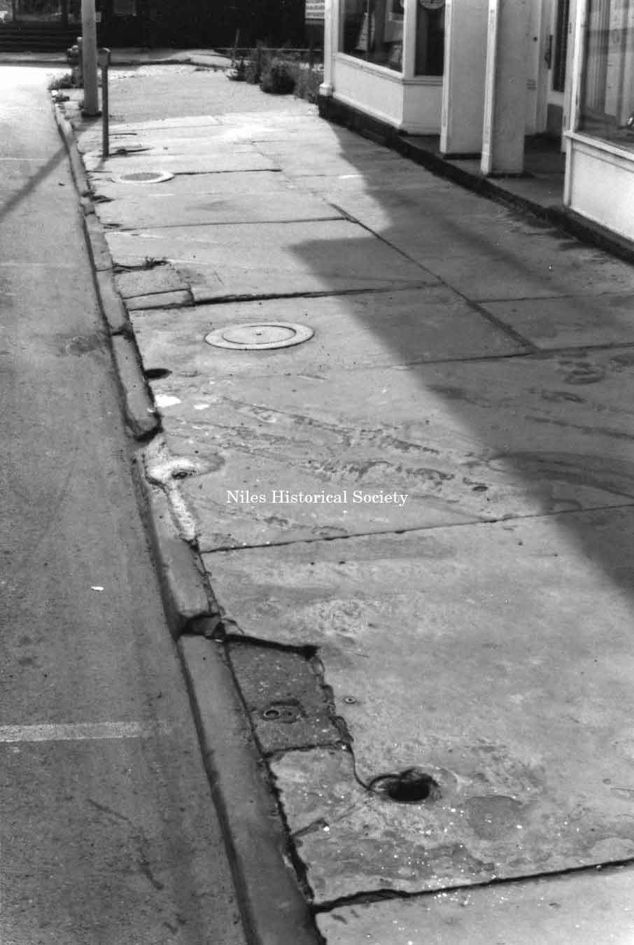
Photo of slate sidewalks in front of older buildings in downtown Niles. PO1.110 |
|
|
||
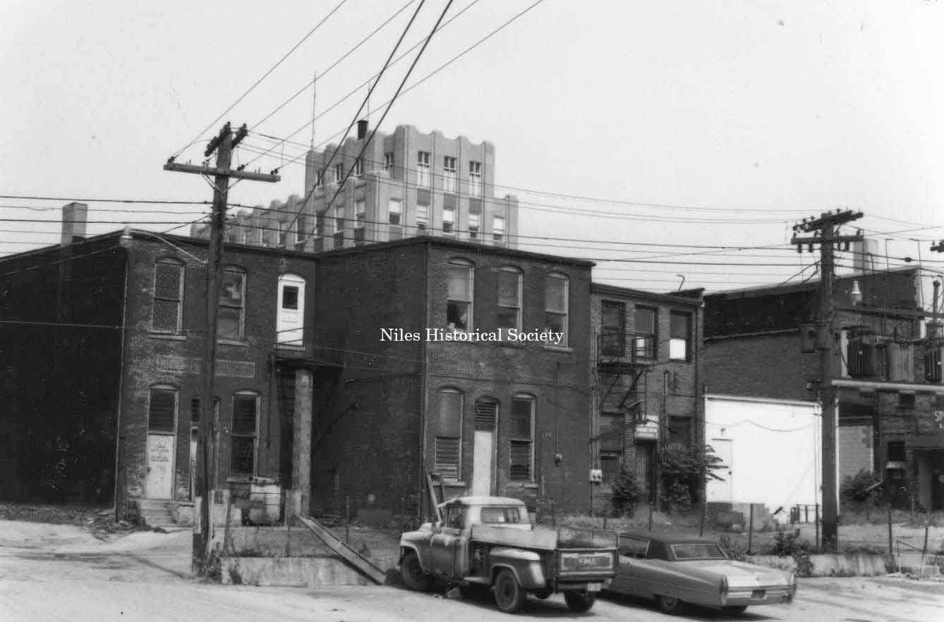
Rear view of several East Park Avenue buildings before urban renewal. Note Spot Restaurant rear entrance. PO1.104 |
Rear façades of several old buildings in downtown Niles prior to urban renewal. PO1.107 |
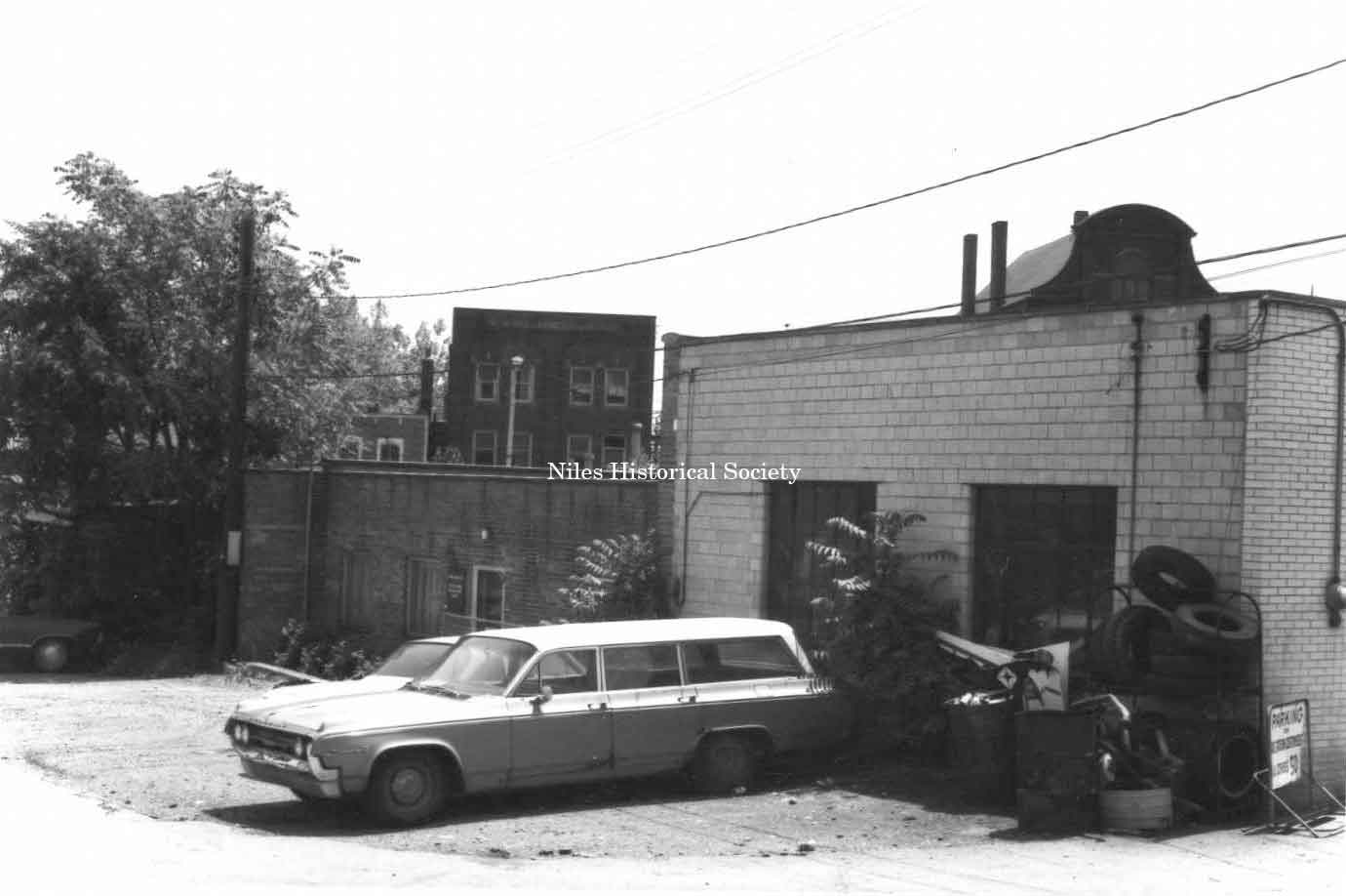
Side view of Sammy Bernard’s Arco gas station located on Pine Alley before urban renewal. PO1.113 |
Photograph dated June 11, 1972 taken of the west side of Doubet’s Jewelry Store. This is oldest (1887) of the original stores left in town. PO1.94 |
Photo taken of the rear of the Mango Building which housed the Shaker Department Store at the corner of East State Street and Park Avenue. PO1.117 |
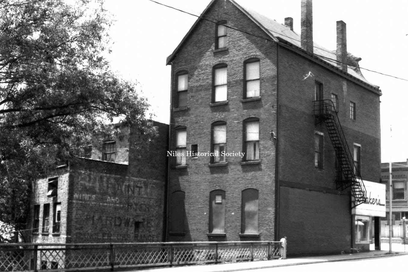
Photo taken showing the marked deterioration of the old Warner Theatre Building located on East State Street in downtown Niles. PO1.167 |
Photo take of the rear façades of several buildings on South Main Street, east side. Note the tower of the Niles Bank Building in the upper center of photo. PO1.105 |
Rear façades of Western Auto building and neighboring buildings. These were located on East State Street. PO1.106 |
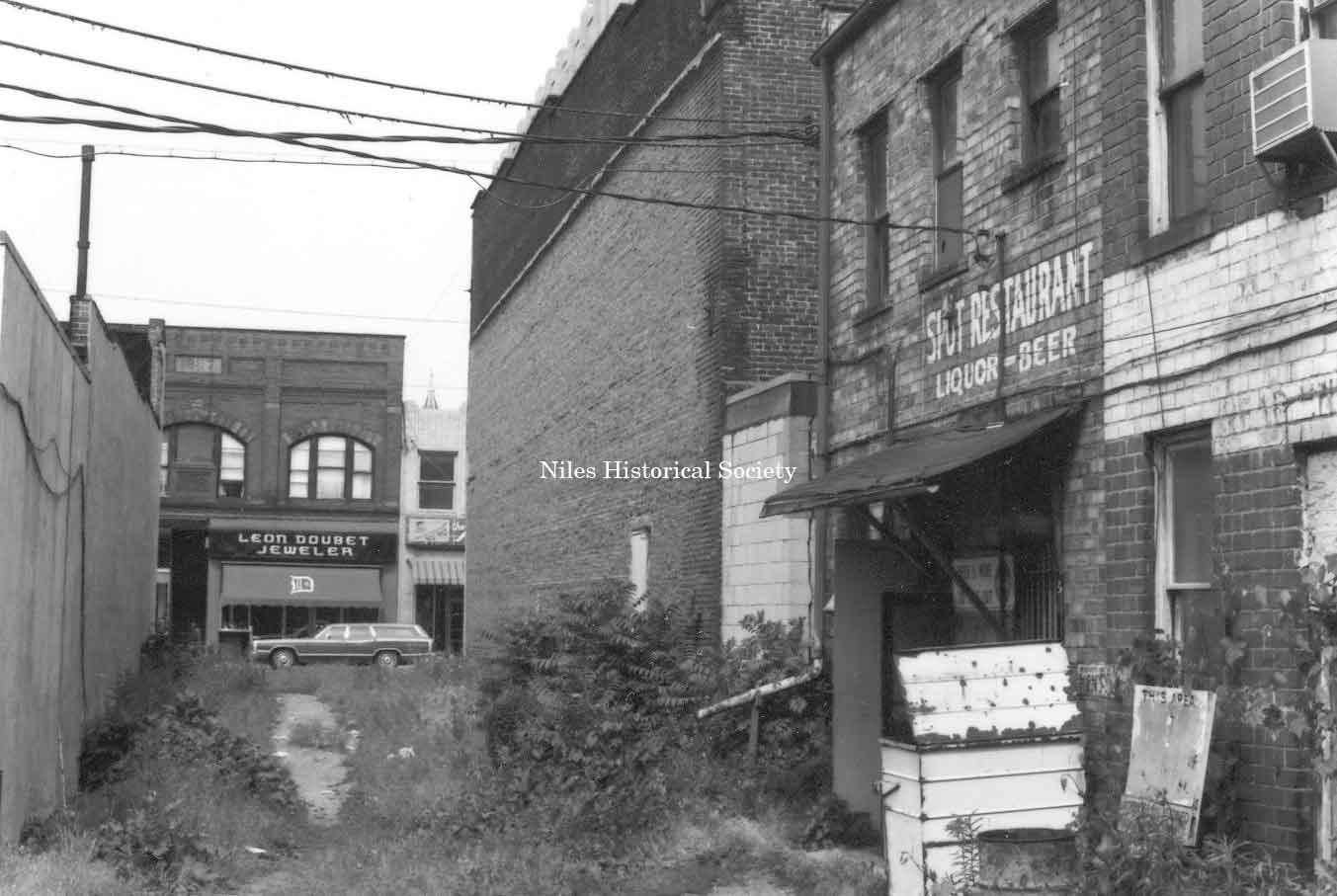
Rear façade of the Spot restaurant located on East Park Avenue in Niles. PO1.109 |
|
|
||
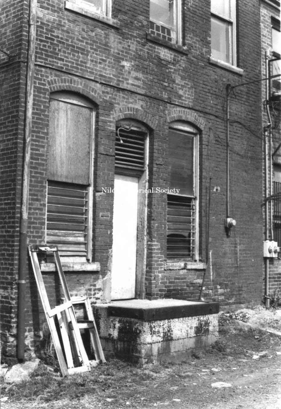
Photo taken of rear entrance to a building located in downtown Niles before urban renewal. PO1.108 |
Rear façade of the Landmark Cafe located on State Street in front of the Mosquito Creek. PO1.114 |
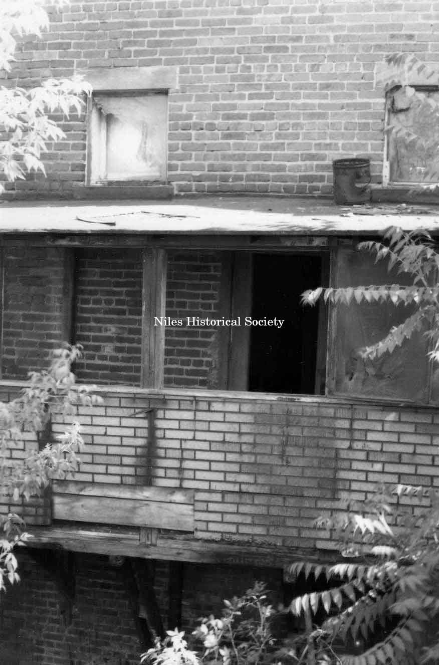
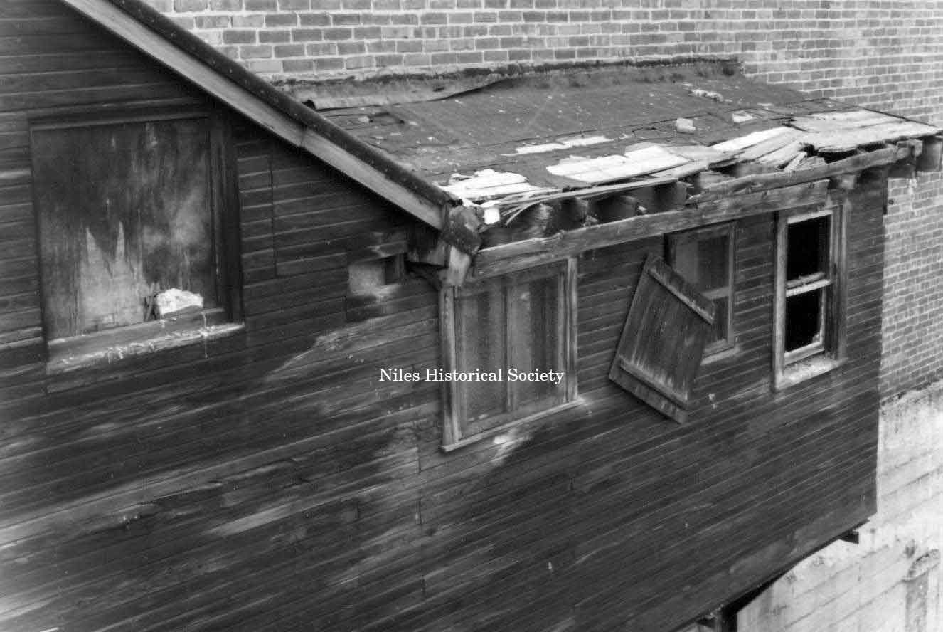
Photo taken of rear façade of building overhanging Mosquito Creek showing marked deterioration. PO1.183 |
|
|
||
|
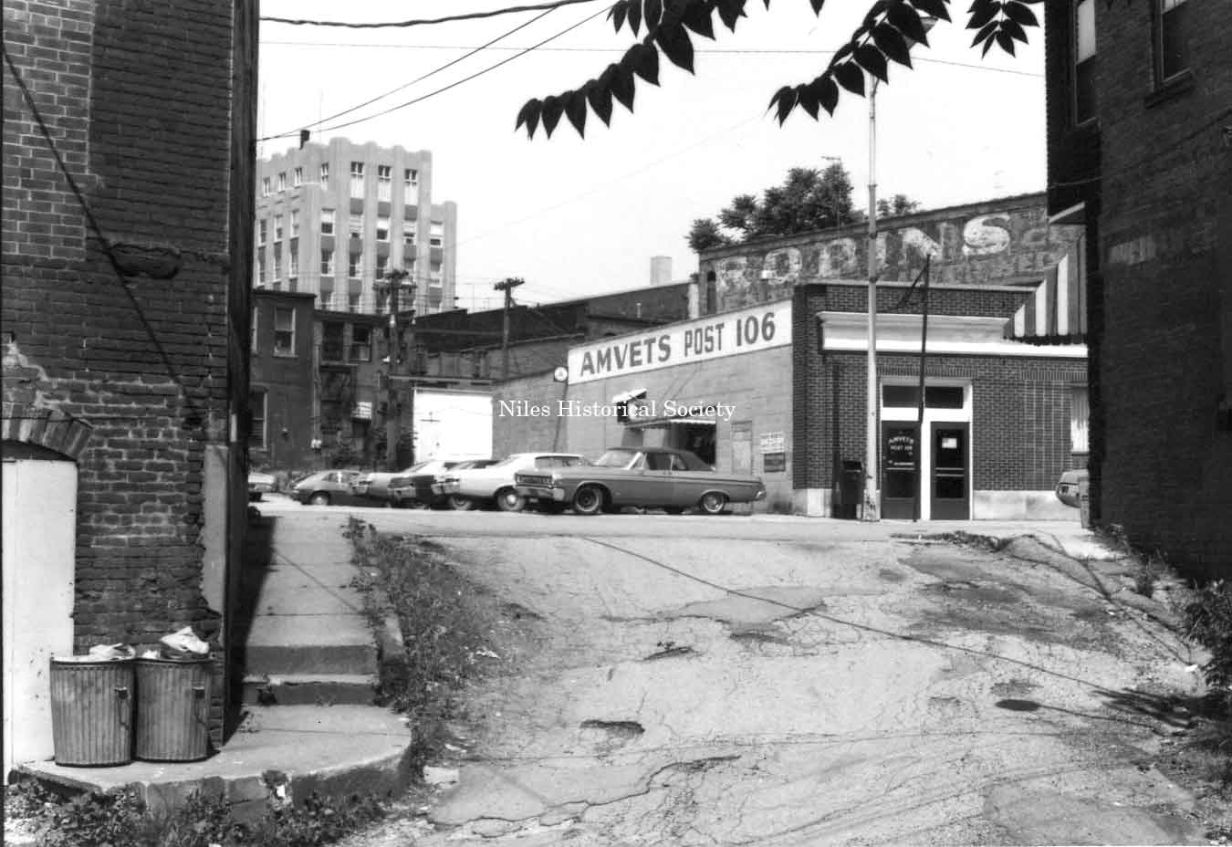
Photo taken of the AMVETS Post 106 located at 76 East State Street looking through Race Alley, a narrow path from the Mosquito Creek dam to the grist mill built in 1806-1807 by James Heaton. PO1.196 |
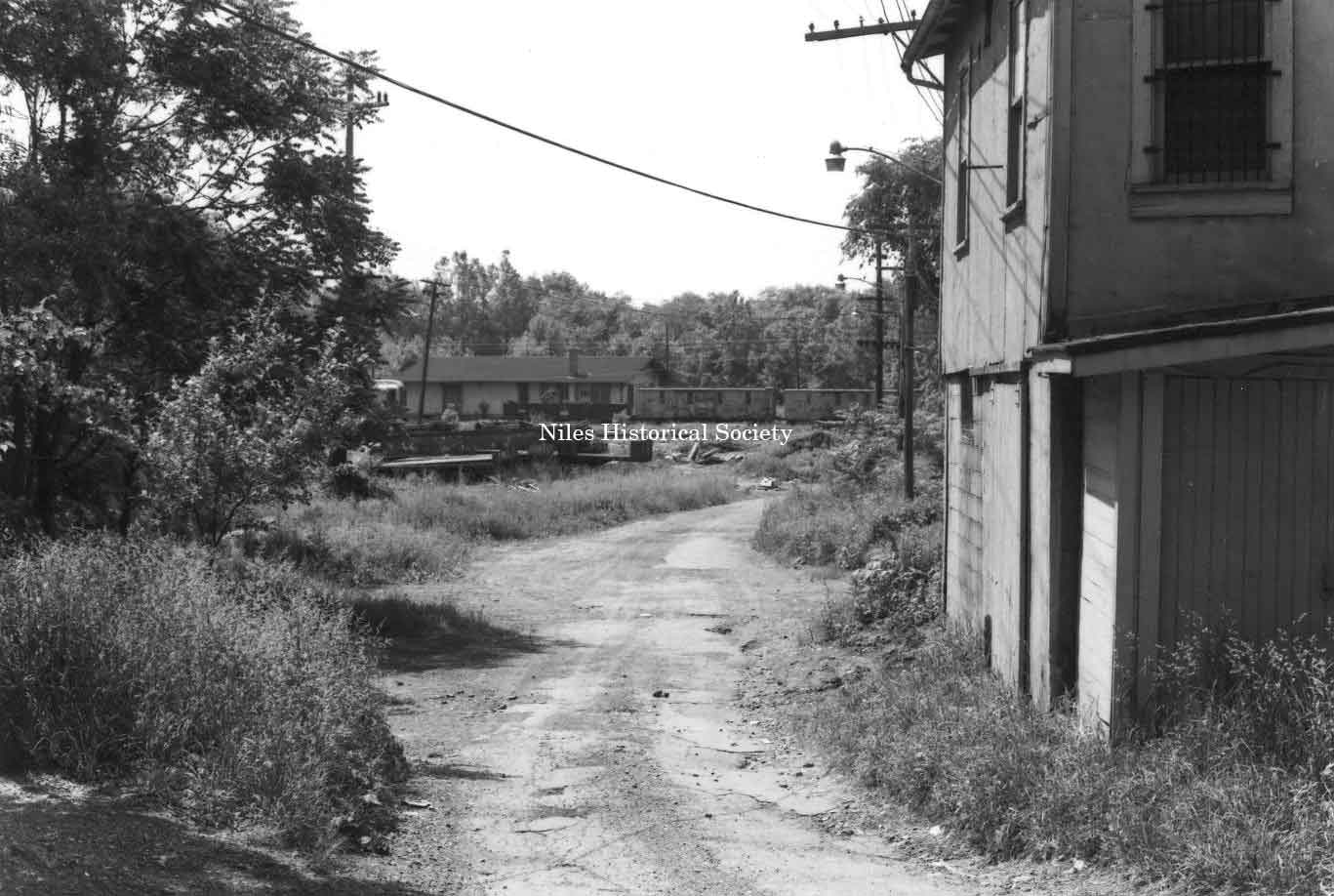
Photo taken of back alley leading to the old Pennsylvania RR station located near the Main Street Viaduct and Mahoning River in downtown Niles before urban renewal. PO1.191 |
Photo taken after the commencement of urban renewal. This is Pine Alley looking north in downtown Niles. PO1.200 |
|
|
||
|
|
||