Ward-Thomas Museum
![]()

Early Street Maps of Niles, Ohio
Ward — Thomas
Museum
Home of the Niles Historical Society
503 Brown Street Niles, Ohio 44446
Click here to become a Niles Historical Society Member or to renew your membership
Click on any photograph to view a larger image, click on image again to zoom into photograph.
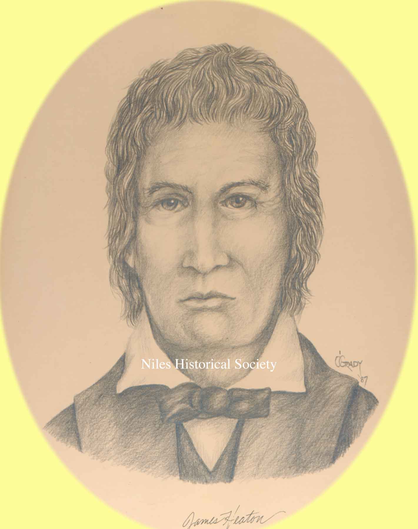
James Heaton Sketch |
Early Street Maps From Centennial Club History, 1934 A map filed in the office of the county recorder, dated 1837, three years after the city was laid out and believed to be the earliest existing map of Niles, shows the extent of the village as planned by James Heaton a century ago. It consisted of eight of the present city blocks included between Church Street on the north, the Mahoning River on the south, Arlington Avenue on the west and State Street on the east. There were no buildings on the east side of what is now State Street and the grassy slope offered an unobstructed view of the creek, the more distant river, the busy grist mill and the smoking Heaton mill in the foreground along the creek (Mosquito) bank. Some of the streets bore different names then
and until much later, Main Street and Water Street were as now,
but Park Avenue was James Street until after 1900 and extended
east only to State Street until after 1900. State Street was Mill
Street as it led directly to the gristmill(and Furnace Street
due to the mills along the Mahoning River), and Arlington Street
was Mechanic Street. |
|
| |
||
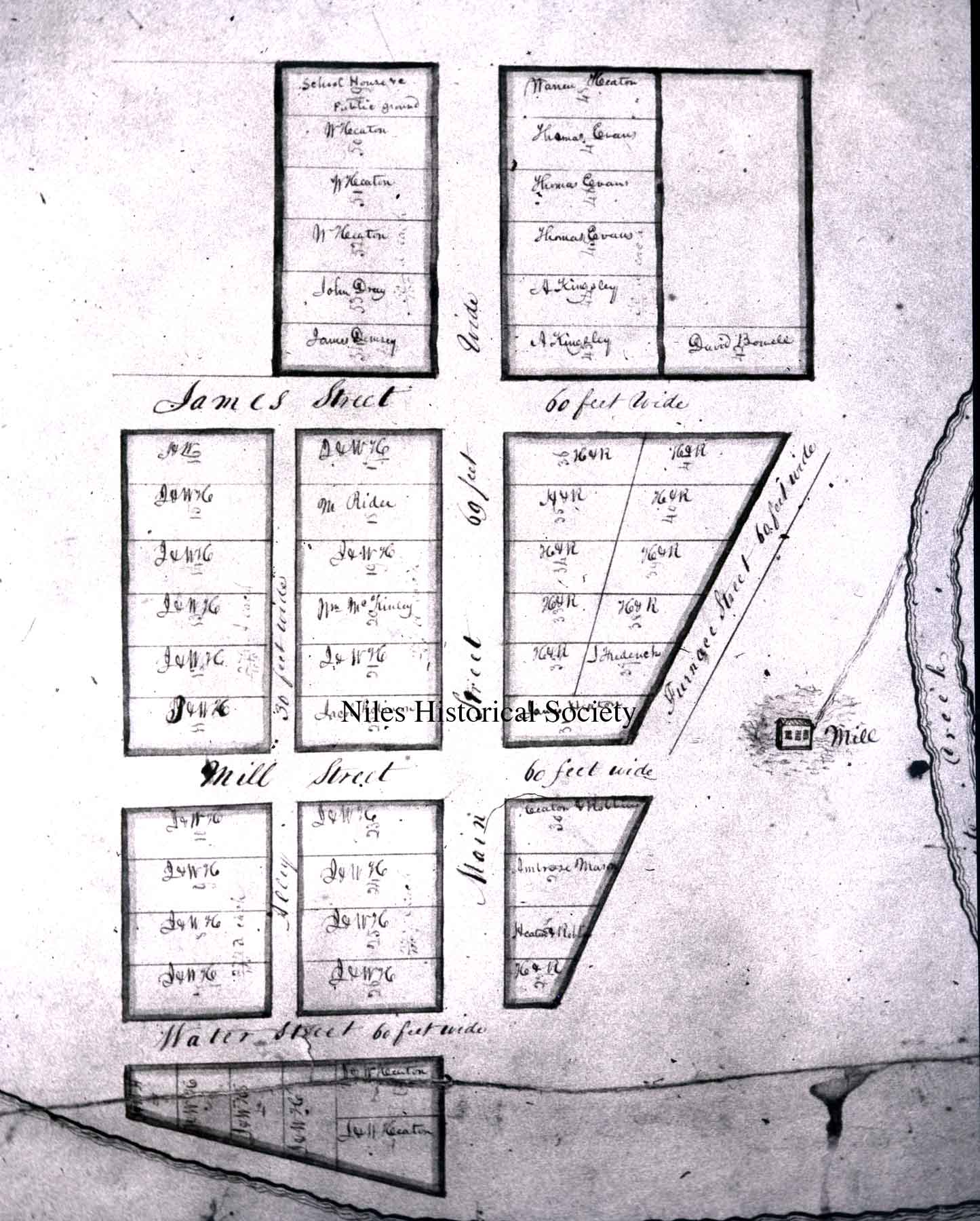 |
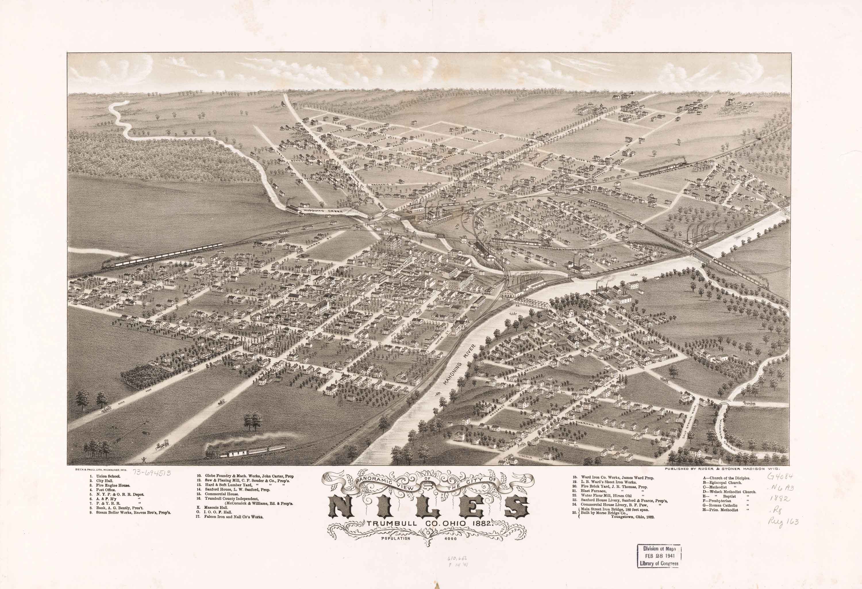
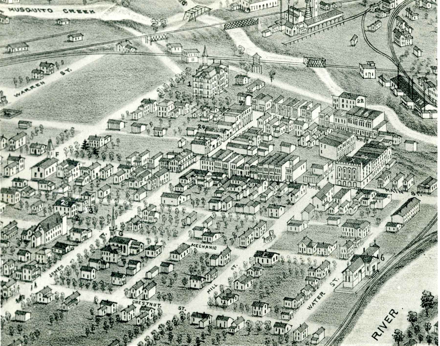
Left: 1837 Map of Heaton Village. PO1.652 Top: 1882 Panoramic View of Niles Right: Close-up of Panoramic View PO1.654 |
|
| |
||
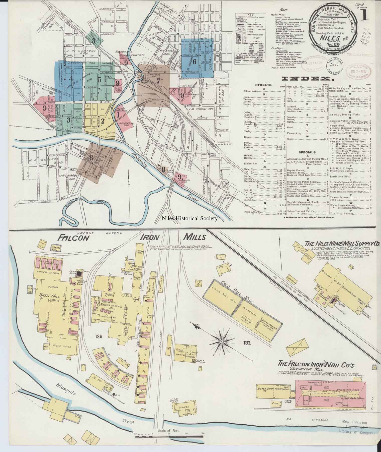
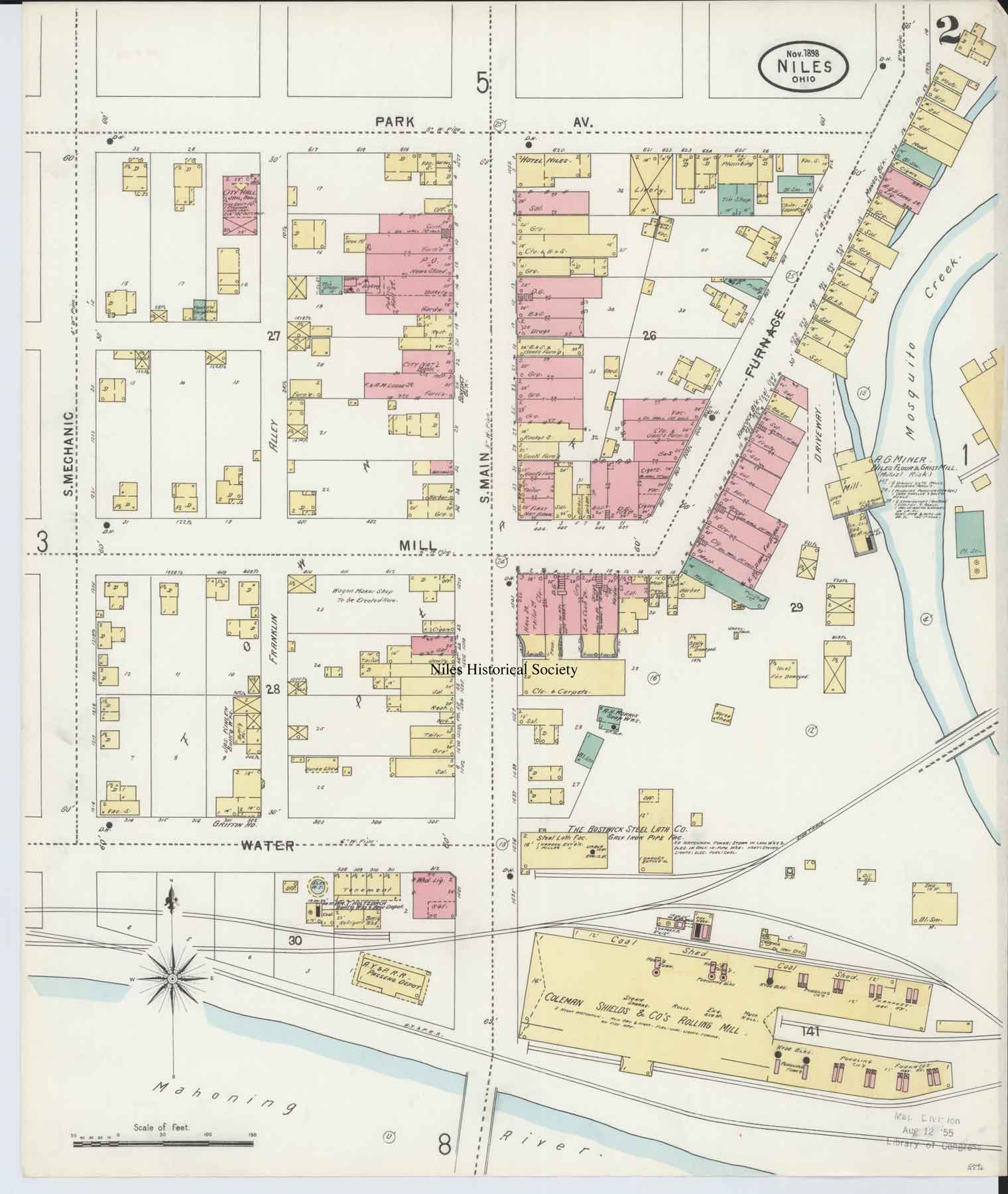
1898 Sandborn-Perris Fire Map of Niles |
1898 Sandborn-Perris Fire Map of Niles |
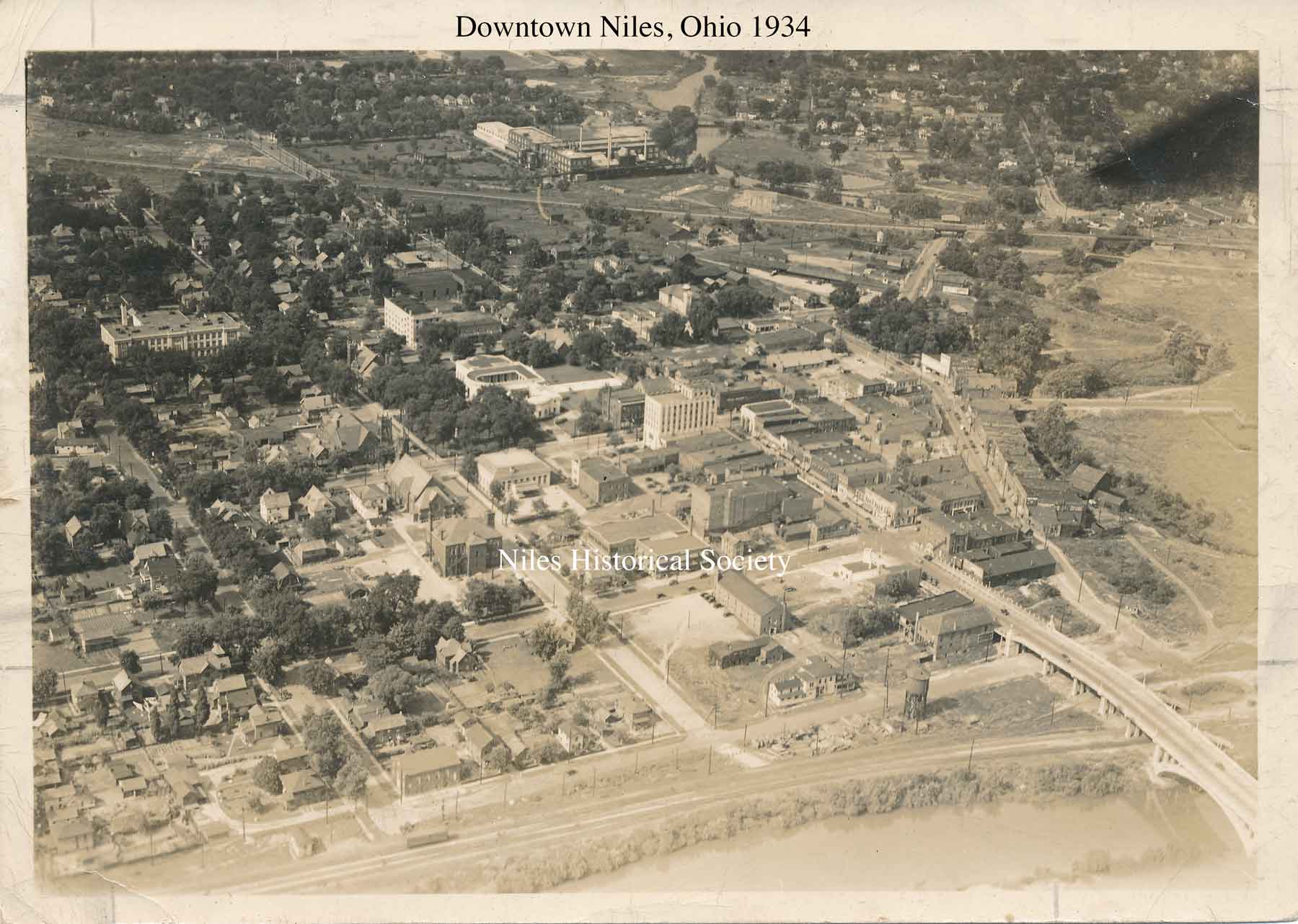
1934 Map of Downtown Niles |
|
|
||